
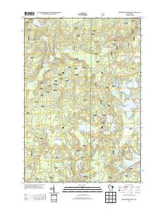
~ Reservoir Pond WI topo map, 1:24000 scale, 7.5 X 7.5 Minute, Historical, 2013
Reservoir Pond, Wisconsin, USGS topographic map dated 2013.
Includes geographic coordinates (latitude and longitude). This topographic map is suitable for hiking, camping, and exploring, or framing it as a wall map.
Printed on-demand using high resolution imagery, on heavy weight and acid free paper, or alternatively on a variety of synthetic materials.
Topos available on paper, Waterproof, Poly, or Tyvek. Usually shipping rolled, unless combined with other folded maps in one order.
- Product Number: USGS-5954009
- Free digital map download (high-resolution, GeoPDF): Reservoir Pond, Wisconsin (file size: 38 MB)
- Map Size: please refer to the dimensions of the GeoPDF map above
- Weight (paper map): ca. 55 grams
- Map Type: POD USGS Topographic Map
- Map Series: US Topo
- Map Verison: Historical
- Cell ID: 71385
- Datum: North American Datum of 1983
- Map Projection: Transverse Mercator
- Map Cell Name: Reservoir Pond
- Grid size: 7.5 X 7.5 Minute
- Date on map: 2013
- Map Scale: 1:24000
- Geographical region: Wisconsin, United States
Neighboring Maps:
All neighboring USGS topo maps are available for sale online at a variety of scales.
Spatial coverage:
Topo map Reservoir Pond, Wisconsin, covers the geographical area associated the following places:
- Jessie Lake - Boot Lake - Lower Hiwanka Lake - Barnes Lake - Explosion Lake - Ada Lake Lookout Tower - Reservoir Pond 22.0 - Glade Lake - Upper Hiwanka Lake - Lower Wapato Lake - Upper Jones Lake - Barney Spring - Jones Spring - Jones Spring E31.25 Dam - Fanny Lake Walk-in Campground - Lauder Lake - Sasacat Lake - Boot Lake Campground - Jones Spring Impoundment - Mary Lake - Setting Lake - Little Horn Lake - Little Wapato Lake - Ada Lake - Section Ten Lake - Mary Creek - Dollar Lake - Jones Springs Management Area - Barney Creek State Natural Area - Upper Wapato Lake - Fanny Lake - Ada Lake Campground - Lower Jones Lake - Adirondack Shelter - Sasacat Creek - McCaslin Spring - Popple Ridge Snowmobile Trail - Reservoir Pond - Reservoir 2 WP 463 Dam - Jones Spring Impoundment 0.12 Reservoir - Horn Lake - Shay Lake - Bowman Lake
- Map Area ID: AREA45.37545.25-88.75-88.625
- Northwest corner Lat/Long code: USGSNW45.375-88.75
- Northeast corner Lat/Long code: USGSNE45.375-88.625
- Southwest corner Lat/Long code: USGSSW45.25-88.75
- Southeast corner Lat/Long code: USGSSE45.25-88.625
- Northern map edge Latitude: 45.375
- Southern map edge Latitude: 45.25
- Western map edge Longitude: -88.75
- Eastern map edge Longitude: -88.625


