
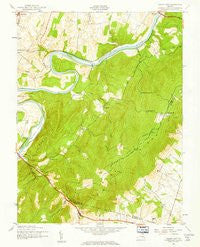
~ Ashby Gap VA topo map, 1:24000 scale, 7.5 X 7.5 Minute, Historical, 1943, updated 1961
Ashby Gap, Virginia, USGS topographic map dated 1943.
Includes geographic coordinates (latitude and longitude). This topographic map is suitable for hiking, camping, and exploring, or framing it as a wall map.
Printed on-demand using high resolution imagery, on heavy weight and acid free paper, or alternatively on a variety of synthetic materials.
Topos available on paper, Waterproof, Poly, or Tyvek. Usually shipping rolled, unless combined with other folded maps in one order.
- Product Number: USGS-5953131
- Free digital map download (high-resolution, GeoPDF): Ashby Gap, Virginia (file size: 10 MB)
- Map Size: please refer to the dimensions of the GeoPDF map above
- Weight (paper map): ca. 55 grams
- Map Type: POD USGS Topographic Map
- Map Series: HTMC
- Map Verison: Historical
- Cell ID: 1634
- Scan ID: 8034470
- Imprint Year: 1961
- Woodland Tint: Yes
- Aerial Photo Year: 1942
- Field Check Year: 1943
- Datum: NAD27
- Map Projection: Polyconic
- Map published by United States Geological Survey
- Map published by United States Army Corps of Engineers
- Map Language: English
- Scanner Resolution: 600 dpi
- Map Cell Name: Ashby Gap
- Grid size: 7.5 X 7.5 Minute
- Date on map: 1943
- Map Scale: 1:24000
- Geographical region: Virginia, United States
Neighboring Maps:
All neighboring USGS topo maps are available for sale online at a variety of scales.
Spatial coverage:
Topo map Ashby Gap, Virginia, covers the geographical area associated the following places:
- Spout Run - Care Free Acres - Longwood - Frogtown - Lockes Landing - Ashby Gap Estates - Fisher Hill - Paris Heights - Willow Lake - Berrys - Top Hill - Mountain Lake - Paris - Calmes Neck Estates - River Park - Chilly Hollow Estates - Barker Land - Pine Acres - Ashby Run - Castlemans Ferry
- Map Area ID: AREA39.12539-78-77.875
- Northwest corner Lat/Long code: USGSNW39.125-78
- Northeast corner Lat/Long code: USGSNE39.125-77.875
- Southwest corner Lat/Long code: USGSSW39-78
- Southeast corner Lat/Long code: USGSSE39-77.875
- Northern map edge Latitude: 39.125
- Southern map edge Latitude: 39
- Western map edge Longitude: -78
- Eastern map edge Longitude: -77.875


