
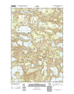
~ White Sand Lake WI topo map, 1:24000 scale, 7.5 X 7.5 Minute, Historical, 2013
White Sand Lake, Wisconsin, USGS topographic map dated 2013.
Includes geographic coordinates (latitude and longitude). This topographic map is suitable for hiking, camping, and exploring, or framing it as a wall map.
Printed on-demand using high resolution imagery, on heavy weight and acid free paper, or alternatively on a variety of synthetic materials.
Topos available on paper, Waterproof, Poly, or Tyvek. Usually shipping rolled, unless combined with other folded maps in one order.
- Product Number: USGS-5952477
- Free digital map download (high-resolution, GeoPDF): White Sand Lake, Wisconsin (file size: 32 MB)
- Map Size: please refer to the dimensions of the GeoPDF map above
- Weight (paper map): ca. 55 grams
- Map Type: POD USGS Topographic Map
- Map Series: US Topo
- Map Verison: Historical
- Cell ID: 48771
- Datum: North American Datum of 1983
- Map Projection: Transverse Mercator
- Map Cell Name: White Sand Lake
- Grid size: 7.5 X 7.5 Minute
- Date on map: 2013
- Map Scale: 1:24000
- Geographical region: Wisconsin, United States
Neighboring Maps:
All neighboring USGS topo maps are available for sale online at a variety of scales.
Spatial coverage:
Topo map White Sand Lake, Wisconsin, covers the geographical area associated the following places:
- Bobs Lake - Starrett Lake - Bear Springs - Partridge Creek - Aurora Lake State Natural Area - Nellie Lake - Lone Tree Lake - Fishtrap IWP1565 Dam - Aurora Lake - Escanaba Lake Hemlocks State Natural Area - Escanaba Lake - Johnson Creek - Plum Lake - Nixon Lake - Mystery Lake - McGinnis Creek - White Birch Lake - Razorback Lake - Frank Lake - Big Muskellunge Lake - Allequash Springs - Partridge Lake - Highland Camp - Spruce Lake - Nixon Creek - Blueberry Lake - White Sand Lake - Fishtrap Lake 59 - Crystal Lake - Pallette Lake - Stevenson Creek Flowage - Nebish Lake - White Birch Creek - Vilas County - Lost Canoe Lake - Allequash Creek - WWMH-FM (Minocqua)
- Map Area ID: AREA46.12546-89.625-89.5
- Northwest corner Lat/Long code: USGSNW46.125-89.625
- Northeast corner Lat/Long code: USGSNE46.125-89.5
- Southwest corner Lat/Long code: USGSSW46-89.625
- Southeast corner Lat/Long code: USGSSE46-89.5
- Northern map edge Latitude: 46.125
- Southern map edge Latitude: 46
- Western map edge Longitude: -89.625
- Eastern map edge Longitude: -89.5


