
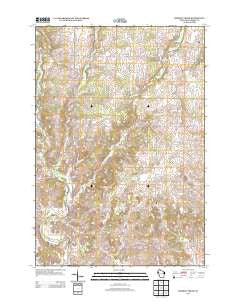
~ Dorrity Creek WI topo map, 1:24000 scale, 7.5 X 7.5 Minute, Historical, 2013
Dorrity Creek, Wisconsin, USGS topographic map dated 2013.
Includes geographic coordinates (latitude and longitude). This topographic map is suitable for hiking, camping, and exploring, or framing it as a wall map.
Printed on-demand using high resolution imagery, on heavy weight and acid free paper, or alternatively on a variety of synthetic materials.
Topos available on paper, Waterproof, Poly, or Tyvek. Usually shipping rolled, unless combined with other folded maps in one order.
- Product Number: USGS-5952291
- Free digital map download (high-resolution, GeoPDF): Dorrity Creek, Wisconsin (file size: 28 MB)
- Map Size: please refer to the dimensions of the GeoPDF map above
- Weight (paper map): ca. 55 grams
- Map Type: POD USGS Topographic Map
- Map Series: US Topo
- Map Verison: Historical
- Cell ID: 12578
- Datum: North American Datum of 1983
- Map Projection: Transverse Mercator
- Map Cell Name: Dorrity Creek
- Grid size: 7.5 X 7.5 Minute
- Date on map: 2013
- Map Scale: 1:24000
- Geographical region: Wisconsin, United States
Neighboring Maps:
All neighboring USGS topo maps are available for sale online at a variety of scales.
Spatial coverage:
Topo map Dorrity Creek, Wisconsin, covers the geographical area associated the following places:
- Pleasant Creek School (historical) - Turtle Creek School (historical) - Town of Arland - 0.05 Reservoir - Dorits School (historical) - Tainter Creek - Columbus School (historical) - Victory School (historical) - Sunset Cemetery - Maple Grove Church (historical) - Nelson Dewey School (historical) - Miller G877 19 Dam - West Dallas School (historical) - Town of Prairie Farm - Dorrity Creek - Maple Grove Cemetery - Sunnyside School (historical) - Young School (historical) - Arland Townhall - Anderson School (historical) - Glenwood Cemetery - Hillcrest Mennonite School - Fourtown Junction School (historical)
- Map Area ID: AREA45.37545.25-92-91.875
- Northwest corner Lat/Long code: USGSNW45.375-92
- Northeast corner Lat/Long code: USGSNE45.375-91.875
- Southwest corner Lat/Long code: USGSSW45.25-92
- Southeast corner Lat/Long code: USGSSE45.25-91.875
- Northern map edge Latitude: 45.375
- Southern map edge Latitude: 45.25
- Western map edge Longitude: -92
- Eastern map edge Longitude: -91.875


