
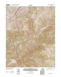
~ Garden City VA topo map, 1:24000 scale, 7.5 X 7.5 Minute, Historical, 2013
Garden City, Virginia, USGS topographic map dated 2013.
Includes geographic coordinates (latitude and longitude). This topographic map is suitable for hiking, camping, and exploring, or framing it as a wall map.
Printed on-demand using high resolution imagery, on heavy weight and acid free paper, or alternatively on a variety of synthetic materials.
Topos available on paper, Waterproof, Poly, or Tyvek. Usually shipping rolled, unless combined with other folded maps in one order.
- Product Number: USGS-5948788
- Free digital map download (high-resolution, GeoPDF): Garden City, Virginia (file size: 38 MB)
- Map Size: please refer to the dimensions of the GeoPDF map above
- Weight (paper map): ca. 55 grams
- Map Type: POD USGS Topographic Map
- Map Series: US Topo
- Map Verison: Historical
- Cell ID: 16786
- Datum: North American Datum of 1983
- Map Projection: Transverse Mercator
- Map Cell Name: Garden City
- Grid size: 7.5 X 7.5 Minute
- Date on map: 2013
- Map Scale: 1:24000
- Geographical region: Virginia, United States
Neighboring Maps:
All neighboring USGS topo maps are available for sale online at a variety of scales.
Spatial coverage:
Topo map Garden City, Virginia, covers the geographical area associated the following places:
- Glenwood Estates - Green Valley - Leslie - Clearbrook - Jefferson Hills - Glenmont - Edgehill Estates - Beechwood Gardens - Castle Hill - Algoma Park - Southern Hills - Southern Pines - Pinkard Court - Starkey - Crescent Heights - Woods Crossing - Greenland Hills - Englewood - Parkway Acres - Hampden Hills - East Pointe - Sherwood Forest - Beulah Heights - Meadowlark - Clermont Heights - Brambleton Court - Mount Pleasant - Parkway Meadows - Ruxton - Spring Valley - Hunting Hills - Prospect Hills - Crystal Spring - Yellowstone - Grandin Court - Jefferson Park - Chapel Forest - Chestnut Hills - Richart Heights - Homeland Hills - Mill Mountain Estates - Garden City - Rockingham Court - Suncrest Heights - Edgehill - Wright - Dundee - Rorer Mines (historical) - Georgetown Park - Narrows - Woodcliff - Peakwood Hills - Prospect Valley - Branderwood - Wildwood - Greenwood Forest - Chesterfield - Cobleshaw - Ogden Hills - Yostland Heights - Fralin Park
- Map Area ID: AREA37.2537.125-80-79.875
- Northwest corner Lat/Long code: USGSNW37.25-80
- Northeast corner Lat/Long code: USGSNE37.25-79.875
- Southwest corner Lat/Long code: USGSSW37.125-80
- Southeast corner Lat/Long code: USGSSE37.125-79.875
- Northern map edge Latitude: 37.25
- Southern map edge Latitude: 37.125
- Western map edge Longitude: -80
- Eastern map edge Longitude: -79.875


