
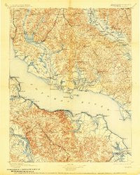
~ Nomini VA topo map, 1:125000 scale, 30 X 30 Minute, Historical, 1898, updated 1907
Nomini, Virginia, USGS topographic map dated 1898.
Includes geographic coordinates (latitude and longitude). This topographic map is suitable for hiking, camping, and exploring, or framing it as a wall map.
Printed on-demand using high resolution imagery, on heavy weight and acid free paper, or alternatively on a variety of synthetic materials.
Topos available on paper, Waterproof, Poly, or Tyvek. Usually shipping rolled, unless combined with other folded maps in one order.
- Product Number: USGS-5930501
- Free digital map download (high-resolution, GeoPDF): Nomini, Virginia (file size: 10 MB)
- Map Size: please refer to the dimensions of the GeoPDF map above
- Weight (paper map): ca. 55 grams
- Map Type: POD USGS Topographic Map
- Map Series: HTMC
- Map Verison: Historical
- Cell ID: 65240
- Scan ID: 461572
- Imprint Year: 1907
- Survey Year: 1890
- Datum: Unstated
- Map Projection: Unstated
- Map published by United States Geological Survey
- Map Language: English
- Scanner Resolution: 600 dpi
- Map Cell Name: Colonial
- Grid size: 30 X 30 Minute
- Date on map: 1898
- Map Scale: 1:125000
- Geographical region: Virginia, United States
Neighboring Maps:
All neighboring USGS topo maps are available for sale online at a variety of scales.
Spatial coverage:
Topo map Nomini, Virginia, covers the geographical area associated the following places:
- Tall Timbers - Mackall - Charleston Creek - Wicomico Shores - Bel Alton - Nomini - West Hatton - Wakefield Corner - Lower Brambley (historical) - Gravelly Hills - Harryhogan - Bushwood - Oak Grove - Mutual Estates - Winterseat - Williams Wharf - Halls Hacienda - Chiltons - Laurel Grove - Lothair Station - Maryland Gardens - Summerseat - Dentsville - Foxwell Point - Hinnom - Grays Corner - China Hill - Sandy Point - Cooksey Knolls - Britton - Knollcrest - Wells Cove - Tompkinsville - Mill Point Shores - Olde Mill - Cooney Neck Estate - Cypress Knolls - Pinemore - Green Acres - Tolson - Bowens - Blue Dolphin Estates - Deer Park - Lancaster Hill - Adelina - Milestown - Sandyland Beach - Baynesville - Kenwood Beach - Harbor Hills - Shamrock Glen Estates - Lanedon - Stilltown (historical) - Redgate - Allens Fresh - Newland - Tucker Hill - Blakistone - Drumcliff - Germans Corner - Herring Creek - Peeds - Classic Shore - Breton Woods - California - Oak Row - Potomac Mills - Bluff Woods - Cremona - Amberleigh Farms - Sandgates - Lerty - Meter - Newmarket - Lane Beach - Cobb Island - Saint Margarets Grove - Big Oak - Swan Point - Bayside - Dynard - Chickasaw Run - Kinsale - Yellow Bank - Montross - Honey Cove Estates - Rogers Mill - Chingville - Springfield - Huckleberry - Helen Estates - Dubois - Longview Beach - Mechanicsville - Willerle Manor - Maple Run - Hillville - Widow Woods - Bel Alton Estates - Foneswood
- Map Area ID: AREA38.538-77-76.5
- Northwest corner Lat/Long code: USGSNW38.5-77
- Northeast corner Lat/Long code: USGSNE38.5-76.5
- Southwest corner Lat/Long code: USGSSW38-77
- Southeast corner Lat/Long code: USGSSE38-76.5
- Northern map edge Latitude: 38.5
- Southern map edge Latitude: 38
- Western map edge Longitude: -77
- Eastern map edge Longitude: -76.5


