
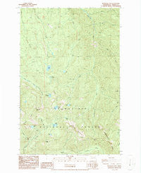
~ Bearhead Mtn WA topo map, 1:24000 scale, 7.5 X 7.5 Minute, Historical, 1986, updated 1986
Bearhead Mtn, Washington, USGS topographic map dated 1986.
Includes geographic coordinates (latitude and longitude). This topographic map is suitable for hiking, camping, and exploring, or framing it as a wall map.
Printed on-demand using high resolution imagery, on heavy weight and acid free paper, or alternatively on a variety of synthetic materials.
Topos available on paper, Waterproof, Poly, or Tyvek. Usually shipping rolled, unless combined with other folded maps in one order.
- Product Number: USGS-5689702
- Free digital map download (high-resolution, GeoPDF): Bearhead Mtn, Washington (file size: 16 MB)
- Map Size: please refer to the dimensions of the GeoPDF map above
- Weight (paper map): ca. 55 grams
- Map Type: POD USGS Topographic Map
- Map Series: HTMC
- Map Verison: Historical
- Cell ID: 2868
- Scan ID: 239975
- Imprint Year: 1986
- Woodland Tint: Yes
- Visual Version Number: 1
- Aerial Photo Year: 1982
- Edit Year: 1986
- Field Check Year: 1984
- Datum: NAD27
- Map Projection: Lambert Conformal Conic
- Provisional map: Yes
- Map Language: English
- Scanner Resolution: 600 dpi
- Map Cell Name: Bearhead Mountain
- Grid size: 7.5 X 7.5 Minute
- Date on map: 1986
- Map Scale: 1:24000
- Geographical region: Washington, United States
Neighboring Maps:
All neighboring USGS topo maps are available for sale online at a variety of scales.
Spatial coverage:
Topo map Bearhead Mtn, Washington, covers the geographical area associated the following places:
- East Lake - Bearhead Mountain - Coplay Lake - Lyle Lake - Summit Lake Trail - Clipper Mine - Milky Creek - Clearwater Wilderness - Carbon Trail - Cayada Mountain - Lily Lake - Twin Lake - Clearwater Trail - Surprise Lake - Rooster Comb - Double Camp Shelter - Queen Bee Mine - Byron Creek - W-E Camp Shelter - McGilvery Creek - Kennedy Creek - Test Creek - Coundly Lake - Pitcher Mountain - Hurricane Gap - Dry Camp - Lyle Creek - Copper King Mine - Martin Gap - Lily Creek - Cedar Lake - Mineral Creek - Frog Mountain - Summit Lake - Falls Creek - Celery Meadow
- Map Area ID: AREA47.12547-121.875-121.75
- Northwest corner Lat/Long code: USGSNW47.125-121.875
- Northeast corner Lat/Long code: USGSNE47.125-121.75
- Southwest corner Lat/Long code: USGSSW47-121.875
- Southeast corner Lat/Long code: USGSSE47-121.75
- Northern map edge Latitude: 47.125
- Southern map edge Latitude: 47
- Western map edge Longitude: -121.875
- Eastern map edge Longitude: -121.75


