
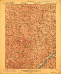
~ New Matamoras WV topo map, 1:62500 scale, 15 X 15 Minute, Historical, 1905, updated 1916
New Matamoras, West Virginia, USGS topographic map dated 1905.
Includes geographic coordinates (latitude and longitude). This topographic map is suitable for hiking, camping, and exploring, or framing it as a wall map.
Printed on-demand using high resolution imagery, on heavy weight and acid free paper, or alternatively on a variety of synthetic materials.
Topos available on paper, Waterproof, Poly, or Tyvek. Usually shipping rolled, unless combined with other folded maps in one order.
- Product Number: USGS-5689588
- Free digital map download (high-resolution, GeoPDF): New Matamoras, West Virginia (file size: 9 MB)
- Map Size: please refer to the dimensions of the GeoPDF map above
- Weight (paper map): ca. 55 grams
- Map Type: POD USGS Topographic Map
- Map Series: HTMC
- Map Verison: Historical
- Cell ID: 58377
- Scan ID: 701158
- Imprint Year: 1916
- Survey Year: 1903
- Datum: Unstated
- Map Projection: Unstated
- Map published by United States Geological Survey
- Map Language: English
- Scanner Resolution: 508 dpi
- Map Cell Name: New Matamoras
- Grid size: 15 X 15 Minute
- Date on map: 1905
- Map Scale: 1:62500
- Geographical region: West Virginia, United States
Neighboring Maps:
All neighboring USGS topo maps are available for sale online at a variety of scales.
Spatial coverage:
Topo map New Matamoras, West Virginia, covers the geographical area associated the following places:
- Greenbrier - Hartshorn - Hohman - Trail Run (historical) - Antioch - New Matamoras - Cross Keys (historical) - Fly - Wahanaker - Sycamore Valley - Laings - Edwina - Alexis - Mechanicsburg - Cline - Bloomfield - Friendly - Shay - Poulton - Foxtown - Rinard Mills - Hilltop - Grandview - Glass - Quarry (historical) - Griffith - Ward (historical) - Brownsville - Jericho - Graham - Benwood - Graysville - Marr - Wingett Run - Sprague - Cranenest - Plainview - Carter (historical) - Centerview (historical) - Way - Muskingum (historical) - Stringtown (historical)
- Map Area ID: AREA39.7539.5-81.25-81
- Northwest corner Lat/Long code: USGSNW39.75-81.25
- Northeast corner Lat/Long code: USGSNE39.75-81
- Southwest corner Lat/Long code: USGSSW39.5-81.25
- Southeast corner Lat/Long code: USGSSE39.5-81
- Northern map edge Latitude: 39.75
- Southern map edge Latitude: 39.5
- Western map edge Longitude: -81.25
- Eastern map edge Longitude: -81


