
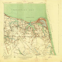
~ Cape Henry VA topo map, 1:62500 scale, 15 X 15 Minute, Historical, 1919, updated 1925
Cape Henry, Virginia, USGS topographic map dated 1919.
Includes geographic coordinates (latitude and longitude). This topographic map is suitable for hiking, camping, and exploring, or framing it as a wall map.
Printed on-demand using high resolution imagery, on heavy weight and acid free paper, or alternatively on a variety of synthetic materials.
Topos available on paper, Waterproof, Poly, or Tyvek. Usually shipping rolled, unless combined with other folded maps in one order.
- Product Number: USGS-5686863
- Free digital map download (high-resolution, GeoPDF): Cape Henry, Virginia (file size: 8 MB)
- Map Size: please refer to the dimensions of the GeoPDF map above
- Weight (paper map): ca. 55 grams
- Map Type: POD USGS Topographic Map
- Map Series: HTMC
- Map Verison: Historical
- Cell ID: 52135
- Scan ID: 187927
- Imprint Year: 1925
- Survey Year: 1918
- Datum: NAD
- Map Projection: Polyconic
- Map published by United States Geological Survey
- Map published by United States Army Corps of Engineers
- Map published by United States Department of War
- Keywords: Overedge
- Map Language: English
- Scanner Resolution: 600 dpi
- Map Cell Name: Cape Henry
- Grid size: 15 X 15 Minute
- Date on map: 1919
- Map Scale: 1:62500
- Geographical region: Virginia, United States
Neighboring Maps:
All neighboring USGS topo maps are available for sale online at a variety of scales.
Spatial coverage:
Topo map Cape Henry, Virginia, covers the geographical area associated the following places:
- Indian River Estates - Avalon Hills - Bay Colony - College Park - Daugherty Trailer Court - Hollywood - Birchwood-Gardens - Cottage Park - Pembroke Manor - Foundation Park - Arrowhead - Colony Acres - Beechwood - Aragona Village - Forest Hills - Norview - Larkspur - Cape Henry Village - Brookfield Park - Cardinal Estates - Broad Bay Colony - Bayville Park - Pecan Gardens - East Ocean View - North Rolleston - Sherry Park - Bel-Aire - Norfolk Highlands - Estabrook Park - Fentress - Bay Island - Kempsville Gardens - Snug Harbor - Easton Place - Pinetta - Glenwood - Bellwood Meadows - Brandon Place - Westview Village - River Oaks - Eastern Park - Woodhouse Corner - Acredale - Linkhorn Shores - Camden Heights - Great Neck Estates - Fox Hall (historical) - Thalia Gardens - Cape Story by the Sea - Glen Rock - Pooles - Southern Points - Lakeview Park - Macons Corner - Larrymore Acres - Linkhorn Estates - Pocahontas Village - Kempsville Heights - El Dorado Trailer Park - Wayside Manor - Windsor Woods - Oceana - Derby Run Mobile Home Park - Lynnwood - Gatewood Park - The Lakes - Magic Hollow - North Linkhorn Park - Grandy Park - Sewells Gardens - Thalia Shores - Whitehurst Landing - Eureka Park - Princess Anne - Mears Corner - Thalia Village - Diamond Lake Estates - Alanton - Lakeville Estates - Ashley Woods - Hyde Park Homes - Tarrallton - Point O'Woods - Estabrook - Ballylynn Shores - Colonial Run Mobile Home Park - New Town (historical) - Plantation Lakes - Kings Arm - Ventosa - Ingleside - Charlestown Lakes - Thalia Manor - Homestead - Hewitt Farm - Lakeview Shores - Azalea Acres - Elizabeth Park - Thoroughgood - Bellany Manor
- Map Area ID: AREA3736.75-76.25-76
- Northwest corner Lat/Long code: USGSNW37-76.25
- Northeast corner Lat/Long code: USGSNE37-76
- Southwest corner Lat/Long code: USGSSW36.75-76.25
- Southeast corner Lat/Long code: USGSSE36.75-76
- Northern map edge Latitude: 37
- Southern map edge Latitude: 36.75
- Western map edge Longitude: -76.25
- Eastern map edge Longitude: -76


