
~ Copalis Beach WA topo map, 1:250000 scale, 2 X 1 Degree, Historical, 1957, updated 1968
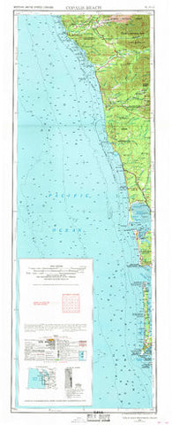
Copalis Beach, Washington, USGS topographic map dated 1957.
Includes geographic coordinates (latitude and longitude). This topographic map is suitable for hiking, camping, and exploring, or framing it as a wall map.
Printed on-demand using high resolution imagery, on heavy weight and acid free paper, or alternatively on a variety of synthetic materials.
Topos available on paper, Waterproof, Poly, or Tyvek. Usually shipping rolled, unless combined with other folded maps in one order.
- Product Number: USGS-5680665
- Free digital map download (high-resolution, GeoPDF): Copalis Beach, Washington (file size: 15 MB)
- Map Size: please refer to the dimensions of the GeoPDF map above
- Weight (paper map): ca. 55 grams
- Map Type: POD USGS Topographic Map
- Map Series: HTMC
- Map Verison: Historical
- Cell ID: 320755
- Scan ID: 240663
- Imprint Year: 1968
- Woodland Tint: Yes
- Edit Year: 1968
- Field Check Year: 1957
- Datum: Unstated
- Map Projection: Transverse Mercator
- Map published by United States Army Corps of Engineers
- Map published by United States Army
- Map Language: English
- Scanner Resolution: 600 dpi
- Map Cell Name: Copalis Beach
- Grid size: 2 X 1 Degree
- Date on map: 1957
- Map Scale: 1:250000
- Geographical region: Washington, United States
Neighboring Maps:
All neighboring USGS topo maps are available for sale online at a variety of scales.
Spatial coverage:
Topo map Copalis Beach, Washington, covers the geographical area associated the following places:
- Ma and Pas Mobile Home Park - Kalaloch - Sampson - Forks - Gray Gables - Mora - La Push - Pacific City (historical) - Ocean City - Bay City - Clearwater - Taholah - Driftwood Mobile Home Park - Ilwaco - Ocean Park - Klipsan Meadows Park - Cohassett Beach - Grayland - Marietta Mobile Home Court - Iron Springs - Aloha - Oceanview - Queets - Pacific Beach - Moclips - Oysterville - Westhaven - Hoh - Onslow - Ocosta - Ocean Bay Mobile Home Park - Hines - Copalis Beach - Oyehut - Breakers - Oil City - Seaview - El Mar Estates Mobile Home Park - Muralts Mobile Home Park - Pacific West Mobile Home Park - Highland Heights - Sand - Lo Trailer Park - Sunset Beach - Carlisle West - Westport - Long Beach - Loomis - Newton - Quillayute - Copalis Crossing - Cohassett - Oceanside - Carlisle - Fort Canby - Elk Creek Mobile Home Park - Dexter by the Sea - Ocean Grove - Anthonys Mobile Home Court - Tulips - Nahcotta - Moores Corner - Klipsan Beach - Forks Mobile Home Park - Alder Grove Mobile Home Park - Carlisle East - Heather - Rain Forest Mobile Home Park - Holman - Willow Place Mobile Home Park - Laidlow - Wasankaris Mobile Home Park - North Cove - Ocean Shores - Burrows
- Map Area ID: AREA4846-125-124
- Northwest corner Lat/Long code: USGSNW48-125
- Northeast corner Lat/Long code: USGSNE48-124
- Southwest corner Lat/Long code: USGSSW46-125
- Southeast corner Lat/Long code: USGSSE46-124
- Northern map edge Latitude: 48
- Southern map edge Latitude: 46
- Western map edge Longitude: -125
- Eastern map edge Longitude: -124


