
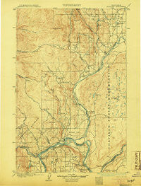
~ Okanogan WA topo map, 1:125000 scale, 30 X 30 Minute, Historical, 1905
Okanogan, Washington, USGS topographic map dated 1905.
Includes geographic coordinates (latitude and longitude). This topographic map is suitable for hiking, camping, and exploring, or framing it as a wall map.
Printed on-demand using high resolution imagery, on heavy weight and acid free paper, or alternatively on a variety of synthetic materials.
Topos available on paper, Waterproof, Poly, or Tyvek. Usually shipping rolled, unless combined with other folded maps in one order.
- Product Number: USGS-5680481
- Free digital map download (high-resolution, GeoPDF): Okanogan, Washington (file size: 10 MB)
- Map Size: please refer to the dimensions of the GeoPDF map above
- Weight (paper map): ca. 55 grams
- Map Type: POD USGS Topographic Map
- Map Series: HTMC
- Map Verison: Historical
- Cell ID: 66237
- Scan ID: 242911
- Survey Year: 1903
- Datum: Unstated
- Map Projection: Unstated
- Map published by United States Geological Survey
- Keywords: Overedge
- Map Language: English
- Scanner Resolution: 600 dpi
- Map Cell Name: Okanogan
- Grid size: 30 X 30 Minute
- Date on map: 1905
- Map Scale: 1:125000
- Geographical region: Washington, United States
Neighboring Maps:
All neighboring USGS topo maps are available for sale online at a variety of scales.
Spatial coverage:
Topo map Okanogan, Washington, covers the geographical area associated the following places:
- Log Cabin Mobile Home Park - Okanogan - Thompson (historical) - Ophir - Brown Lake - Bridgeport - Downing - Brandts Landing - Loop Loop (historical) - Brewster - Malott - Mowich Illahee - Ruby - Paradise Hill - Monse - Virginia City (historical) - Epley (historical) - Mountain View Mobile Home Park - Rocky Butte - Olema - Wakefield - M Bar J Ranch Mobile Home Park - Pateros - Chillowist - Omak
- Map Area ID: AREA48.548-120-119.5
- Northwest corner Lat/Long code: USGSNW48.5-120
- Northeast corner Lat/Long code: USGSNE48.5-119.5
- Southwest corner Lat/Long code: USGSSW48-120
- Southeast corner Lat/Long code: USGSSE48-119.5
- Northern map edge Latitude: 48.5
- Southern map edge Latitude: 48
- Western map edge Longitude: -120
- Eastern map edge Longitude: -119.5


