
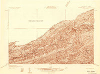
~ Peterstown VA topo map, 1:48000 scale, 15 X 15 Minute, Historical, 1932
Peterstown, Virginia, USGS topographic map dated 1932.
Includes geographic coordinates (latitude and longitude). This topographic map is suitable for hiking, camping, and exploring, or framing it as a wall map.
Printed on-demand using high resolution imagery, on heavy weight and acid free paper, or alternatively on a variety of synthetic materials.
Topos available on paper, Waterproof, Poly, or Tyvek. Usually shipping rolled, unless combined with other folded maps in one order.
- Product Number: USGS-5679080
- Free digital map download (high-resolution, GeoPDF): Peterstown, Virginia (file size: 8 MB)
- Map Size: please refer to the dimensions of the GeoPDF map above
- Weight (paper map): ca. 55 grams
- Map Type: POD USGS Topographic Map
- Map Series: HTMC
- Map Verison: Historical
- Cell ID: 58273
- Scan ID: 253287
- Survey Year: 1932
- Datum: NAD
- Map Projection: Polyconic
- Advance: Yes
- Map published by United States Geological Survey
- Keywords: Nonstandard Press Run
- Map Language: English
- Scanner Resolution: 600 dpi
- Map Cell Name: Narrows
- Grid size: 15 X 15 Minute
- Date on map: 1932
- Map Scale: 1:48000
- Geographical region: Virginia, United States
Neighboring Maps:
All neighboring USGS topo maps are available for sale online at a variety of scales.
Spatial coverage:
Topo map Peterstown, Virginia, covers the geographical area associated the following places:
- Pettry - Lurich - Ballard - Lerona - Mandeville - Cloverdale - Penvir - Narrows - Hatcher - Chestnut Knob - Hill Top - Rich Creek - Cashmere - Bluff City - Lick Creek - Elgood - Thessalia - Kellysville - Cashers Hill - Bozoo - Lovern - Peterstown - Phlegar - French - North Pearisburg - Neponset - Willowton - Gray Sulphur Springs (historical) - Glen Lyn - Stengel (historical) - Shumate - Oakvale - First Ford - Midway - Boxley - Mercers Saltworks (historical)
- Map Area ID: AREA37.537.25-81-80.75
- Northwest corner Lat/Long code: USGSNW37.5-81
- Northeast corner Lat/Long code: USGSNE37.5-80.75
- Southwest corner Lat/Long code: USGSSW37.25-81
- Southeast corner Lat/Long code: USGSSE37.25-80.75
- Northern map edge Latitude: 37.5
- Southern map edge Latitude: 37.25
- Western map edge Longitude: -81
- Eastern map edge Longitude: -80.75


