
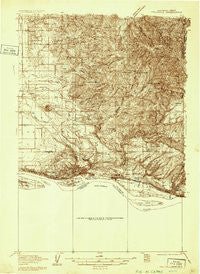
~ Troutdale WA topo map, 1:48000 scale, 15 X 15 Minute, Historical, 1934
Troutdale, Washington, USGS topographic map dated 1934.
Includes geographic coordinates (latitude and longitude). This topographic map is suitable for hiking, camping, and exploring, or framing it as a wall map.
Printed on-demand using high resolution imagery, on heavy weight and acid free paper, or alternatively on a variety of synthetic materials.
Topos available on paper, Waterproof, Poly, or Tyvek. Usually shipping rolled, unless combined with other folded maps in one order.
- Product Number: USGS-5678986
- Free digital map download (high-resolution, GeoPDF): Troutdale, Washington (file size: 14 MB)
- Map Size: please refer to the dimensions of the GeoPDF map above
- Weight (paper map): ca. 55 grams
- Map Type: POD USGS Topographic Map
- Map Series: HTMC
- Map Verison: Historical
- Cell ID: 320629
- Scan ID: 244344
- Survey Year: 1934
- Datum: NAD27
- Map Projection: Polyconic
- Advance: Yes
- Map published by United States Geological Survey
- Keywords: Overedge; Nonstandard Press Run
- Map Language: English
- Scanner Resolution: 600 dpi
- Map Cell Name: Camas
- Grid size: 15 X 15 Minute
- Date on map: 1934
- Map Scale: 1:48000
- Geographical region: Washington, United States
Neighboring Maps:
All neighboring USGS topo maps are available for sale online at a variety of scales.
Spatial coverage:
Topo map Troutdale, Washington, covers the geographical area associated the following places:
- Fern Prairie - Mill Plain - Rockwood - Corbett - Mount Pleasant - Proebstel - Wood Village - Parker Landing Light - Ireland - Hockinson - Troutdale - Springdale - Interlachen - Creswell Heights - Camas - Little Elkhorn - Twelvemile Corner - Fairview - Parkersville - Sunnyside - Livingston - Oak Park - Washougal
- Map Area ID: AREA45.7545.5-122.5-122.25
- Northwest corner Lat/Long code: USGSNW45.75-122.5
- Northeast corner Lat/Long code: USGSNE45.75-122.25
- Southwest corner Lat/Long code: USGSSW45.5-122.5
- Southeast corner Lat/Long code: USGSSE45.5-122.25
- Northern map edge Latitude: 45.75
- Southern map edge Latitude: 45.5
- Western map edge Longitude: -122.5
- Eastern map edge Longitude: -122.25


