
~ Gerrardstown WV topo map, 1:48000 scale, 15 X 15 Minute, Historical, 1914
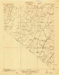
Gerrardstown, West Virginia, USGS topographic map dated 1914.
Includes geographic coordinates (latitude and longitude). This topographic map is suitable for hiking, camping, and exploring, or framing it as a wall map.
Printed on-demand using high resolution imagery, on heavy weight and acid free paper, or alternatively on a variety of synthetic materials.
Topos available on paper, Waterproof, Poly, or Tyvek. Usually shipping rolled, unless combined with other folded maps in one order.
- Product Number: USGS-5659986
- Free digital map download (high-resolution, GeoPDF): Gerrardstown, West Virginia (file size: 8 MB)
- Map Size: please refer to the dimensions of the GeoPDF map above
- Weight (paper map): ca. 55 grams
- Map Type: POD USGS Topographic Map
- Map Series: HTMC
- Map Verison: Historical
- Cell ID: 54554
- Scan ID: 253226
- Survey Year: 1914
- Datum: Unstated
- Map Projection: Unstated
- Advance: Yes
- Planimetric: Yes
- Map published by United States Geological Survey
- Keywords: Overedge; Nonstandard Press Run
- Map Language: English
- Scanner Resolution: 600 dpi
- Map Cell Name: Gerrards Town
- Grid size: 15 X 15 Minute
- Date on map: 1914
- Map Scale: 1:48000
- Geographical region: West Virginia, United States
Neighboring Maps:
All neighboring USGS topo maps are available for sale online at a variety of scales.
Spatial coverage:
Topo map Gerrardstown, West Virginia, covers the geographical area associated the following places:
- Rest - Inwood - Jones Springs - Union Corner - Penry (historical) - Cedar Grove - Gerrardstown - Greenwood - Peach Orchard Inn Farms - Shanghai - Ganotown - Ole Orchard Estates - Ravenwood Estates - Darkesville - De Haveland Estates - Grimes - Arden - Braddock Hills Estates - Cedar Hill - Apple View Estates - Grouse Hollow Estates - Bunker Hill - Tarico Heights - Chestnut Grove Estates - Siler - Shockeysville - De Haven - Tablers Station - Green Spring - Welltown - Clear Brook - Goose Nest - White Hall - Sir John Addition - Glengary - Brucetown - Ridgeway - Gordondale - Light (historical) - Nollville
- Map Area ID: AREA39.539.25-78.25-78
- Northwest corner Lat/Long code: USGSNW39.5-78.25
- Northeast corner Lat/Long code: USGSNE39.5-78
- Southwest corner Lat/Long code: USGSSW39.25-78.25
- Southeast corner Lat/Long code: USGSSE39.25-78
- Northern map edge Latitude: 39.5
- Southern map edge Latitude: 39.25
- Western map edge Longitude: -78.25
- Eastern map edge Longitude: -78


