
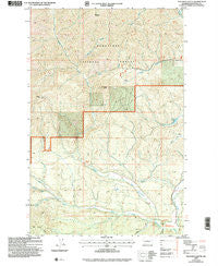
~ Teanaway Butte WA topo map, 1:24000 scale, 7.5 X 7.5 Minute, Historical, 2003, updated 2006
Teanaway Butte, Washington, USGS topographic map dated 2003.
Includes geographic coordinates (latitude and longitude). This topographic map is suitable for hiking, camping, and exploring, or framing it as a wall map.
Printed on-demand using high resolution imagery, on heavy weight and acid free paper, or alternatively on a variety of synthetic materials.
Topos available on paper, Waterproof, Poly, or Tyvek. Usually shipping rolled, unless combined with other folded maps in one order.
- Product Number: USGS-5659948
- Free digital map download (high-resolution, GeoPDF): Teanaway Butte, Washington (file size: 15 MB)
- Map Size: please refer to the dimensions of the GeoPDF map above
- Weight (paper map): ca. 55 grams
- Map Type: POD USGS Topographic Map
- Map Series: HTMC
- Map Verison: Historical
- Cell ID: 44427
- Scan ID: 363017
- Imprint Year: 2006
- Woodland Tint: Yes
- Aerial Photo Year: 1998
- Datum: NAD83
- Map Projection: Universal Transverse Mercator
- Map published by United States Geological Survey
- Map published by United States Forest Service
- Map Language: English
- Scanner Resolution: 600 dpi
- Map Cell Name: Teanaway Butte
- Grid size: 7.5 X 7.5 Minute
- Date on map: 2003
- Map Scale: 1:24000
- Geographical region: Washington, United States
Neighboring Maps:
All neighboring USGS topo maps are available for sale online at a variety of scales.
Spatial coverage:
Topo map Teanaway Butte, Washington, covers the geographical area associated the following places:
- Kittitas County Fire District 7 Station 5 - Bible Rock Childrens Camp - West Fork Teanaway River - Way Creek - Bible Rock Camp - Sandstone Creek - Liars Prairie - Malcolm Creek - Illahee Camp - Indian Camp Campground - Teanaway Butte Lookout - Camp Seventeen Canyon - Casland - Dingbat Creek - Teanaway Campground - North Fork Teanaway River - Teanaway Butte - Carlson Canyon - Beverly Creek - Lllahee Camp - Camp Lake - Middle Fork Teanaway River - Malcolm Mountain - Yellow Hill
- Map Area ID: AREA47.37547.25-121-120.875
- Northwest corner Lat/Long code: USGSNW47.375-121
- Northeast corner Lat/Long code: USGSNE47.375-120.875
- Southwest corner Lat/Long code: USGSSW47.25-121
- Southeast corner Lat/Long code: USGSSE47.25-120.875
- Northern map edge Latitude: 47.375
- Southern map edge Latitude: 47.25
- Western map edge Longitude: -121
- Eastern map edge Longitude: -120.875


