
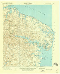
~ Heathsville VA topo map, 1:62500 scale, 15 X 15 Minute, Historical, 1917, updated 1960
Heathsville, Virginia, USGS topographic map dated 1917.
Includes geographic coordinates (latitude and longitude). This topographic map is suitable for hiking, camping, and exploring, or framing it as a wall map.
Printed on-demand using high resolution imagery, on heavy weight and acid free paper, or alternatively on a variety of synthetic materials.
Topos available on paper, Waterproof, Poly, or Tyvek. Usually shipping rolled, unless combined with other folded maps in one order.
- Product Number: USGS-5659786
- Free digital map download (high-resolution, GeoPDF): Heathsville, Virginia (file size: 8 MB)
- Map Size: please refer to the dimensions of the GeoPDF map above
- Weight (paper map): ca. 55 grams
- Map Type: POD USGS Topographic Map
- Map Series: HTMC
- Map Verison: Historical
- Cell ID: 55233
- Scan ID: 188171
- Imprint Year: 1960
- Survey Year: 1917
- Datum: NAD27
- Map Projection: Polyconic
- Map published by United States Geological Survey
- Map published by United States Army Corps of Engineers
- Keywords: Overedge
- Map Language: English
- Scanner Resolution: 600 dpi
- Map Cell Name: Heathsville
- Grid size: 15 X 15 Minute
- Date on map: 1917
- Map Scale: 1:62500
- Geographical region: Virginia, United States
Neighboring Maps:
All neighboring USGS topo maps are available for sale online at a variety of scales.
Spatial coverage:
Topo map Heathsville, Virginia, covers the geographical area associated the following places:
- Folly - Brook Vale - Georgetown - Tipers - Edwardsville - Lewisetta - Williams Corner - Howland - Beverlyville - Heathsville - Waddeys - Coan - Reedville - Burgess - Horse Head - Gonyon - Chesapeake Beach - Nokomis - Middletons Corner - McNeals Corner - Wicomico Church - Sunnybank - Mount Olive - Vir-Mar Beach - Blundon Corner - Blackberry - Ophelia - Lee Dale Shores - Richtown - Luttrels Corner - Cowart - Fleeton - Sissons Corner - Walnut Point (historical) - Mila - Downings Corner - Lankford Corner - Tibitha - Oak Grove - Surprise Hill - Chestnut Grove - Sandy Point - Milestone - Fairport - Browns Corner - Browns Store - Lilian - Claraville - Lake - Crabbe Mill - Bryant Corner - Bundick - Regina - Miskimon - Newtown - Hardins Corner - Hamlins Corner - Remo - Lancaster - Avalon - Blackwells - Jetts Store - Kayan
- Map Area ID: AREA3837.75-76.5-76.25
- Northwest corner Lat/Long code: USGSNW38-76.5
- Northeast corner Lat/Long code: USGSNE38-76.25
- Southwest corner Lat/Long code: USGSSW37.75-76.5
- Southeast corner Lat/Long code: USGSSE37.75-76.25
- Northern map edge Latitude: 38
- Southern map edge Latitude: 37.75
- Western map edge Longitude: -76.5
- Eastern map edge Longitude: -76.25


