
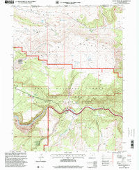
~ Goslin Mountain UT topo map, 1:24000 scale, 7.5 X 7.5 Minute, Historical, 1996, updated 2000
Goslin Mountain, Utah, USGS topographic map dated 1996.
Includes geographic coordinates (latitude and longitude). This topographic map is suitable for hiking, camping, and exploring, or framing it as a wall map.
Printed on-demand using high resolution imagery, on heavy weight and acid free paper, or alternatively on a variety of synthetic materials.
Topos available on paper, Waterproof, Poly, or Tyvek. Usually shipping rolled, unless combined with other folded maps in one order.
- Product Number: USGS-5659678
- Free digital map download (high-resolution, GeoPDF): Goslin Mountain, Utah (file size: 13 MB)
- Map Size: please refer to the dimensions of the GeoPDF map above
- Weight (paper map): ca. 55 grams
- Map Type: POD USGS Topographic Map
- Map Series: HTMC
- Map Verison: Historical
- Cell ID: 17836
- Scan ID: 249557
- Imprint Year: 2000
- Woodland Tint: Yes
- Aerial Photo Year: 1993
- Edit Year: 1996
- Datum: NAD27
- Map Projection: Lambert Conformal Conic
- Map published by United States Geological Survey
- Map published by United States Forest Service
- Keywords: Overedge
- Map Language: English
- Scanner Resolution: 600 dpi
- Map Cell Name: Goslin Mountain
- Grid size: 7.5 X 7.5 Minute
- Date on map: 1996
- Map Scale: 1:24000
- Geographical region: Utah, United States
Neighboring Maps:
All neighboring USGS topo maps are available for sale online at a variety of scales.
Spatial coverage:
Topo map Goslin Mountain, Utah, covers the geographical area associated the following places:
- Goslin Creek - Goslin Mountain Wildlife Management Area - Goslin Mountain - Big Springs - Pugmire Pocket Campground - Uinta Mountains - Jackson Camp - Ford Spring - Big Pine Camp - Pigeon Canyon - Jackson Creek - Little Hotel Campground - Pigeon Basin - Gonge Creek Camp - Dripping Spring - Big Cottonwood Camp - Ford Draw - Edith Aspden Park - Red Canyon - Gorge Creek - Little Devils Hole - Devils Hole - Red Creek Campground - Little Davenport Wildlife Management Area - Red Creek - Devils Hole Camp - Little Davenport Creek - Dripping Spring Campground - Manns Spring - Little Hole Wildlife Management Area - Cow Spring - Trails End Camp
- Map Area ID: AREA4140.875-109.375-109.25
- Northwest corner Lat/Long code: USGSNW41-109.375
- Northeast corner Lat/Long code: USGSNE41-109.25
- Southwest corner Lat/Long code: USGSSW40.875-109.375
- Southeast corner Lat/Long code: USGSSE40.875-109.25
- Northern map edge Latitude: 41
- Southern map edge Latitude: 40.875
- Western map edge Longitude: -109.375
- Eastern map edge Longitude: -109.25


