
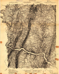
~ Middletown WV topo map, 1:48000 scale, 15 X 15 Minute, Historical, 1908
Middletown, West Virginia, USGS topographic map dated 1908.
Includes geographic coordinates (latitude and longitude). This topographic map is suitable for hiking, camping, and exploring, or framing it as a wall map.
Printed on-demand using high resolution imagery, on heavy weight and acid free paper, or alternatively on a variety of synthetic materials.
Topos available on paper, Waterproof, Poly, or Tyvek. Usually shipping rolled, unless combined with other folded maps in one order.
- Product Number: USGS-5658558
- Free digital map download (high-resolution, GeoPDF): Middletown, West Virginia (file size: 22 MB)
- Map Size: please refer to the dimensions of the GeoPDF map above
- Weight (paper map): ca. 55 grams
- Map Type: POD USGS Topographic Map
- Map Series: HTMC
- Map Verison: Historical
- Cell ID: 50612
- Scan ID: 257262
- Survey Year: 1908
- Datum: Unstated
- Map Projection: Unstated
- Advance: Yes
- Map published by United States Geological Survey
- Keywords: Overedge; Nonstandard Press Run
- Map Language: English
- Scanner Resolution: 600 dpi
- Map Cell Name: Antietam
- Grid size: 15 X 15 Minute
- Date on map: 1908
- Map Scale: 1:48000
- Geographical region: West Virginia, United States
Neighboring Maps:
All neighboring USGS topo maps are available for sale online at a variety of scales.
Spatial coverage:
Topo map Middletown, West Virginia, covers the geographical area associated the following places:
- Lewis Mill - Bradbury Heights - Point of Rocks Estates - North Jefferson - Forge Hill Estates - Neersville - Middletown Manor - Braddock Heights - Lamb Knolls - Minnick - Braddock Estates - Middlebrook - Brownsville - Springdale - Locust Grove - Jefferson Oaks - Countryside West - Pomona - Middletown South - Skyline Estates - EcoVillage of Loudoun County - Pleasantville - Edinburg Forest - Dargan - Mar-Lu-Ridge Vista - Mount Briar - Strawleigh - Bolivar - Jefferson Court - Harmony - Gapland - Brandenburg Estates - Cowell - Middletown View - Fountaindale South - Lovettsville - Rock Hall - Pine Hill Estates - West Middletown Estates - Moser - Olive - Harmony Knolls - Frostown - Jefferson Heights - Remsberg Acres - Taylor Heights - Pleasant Valley - Fairview - Lander - Wiles Estates - Samples Manor - Station Roads - Jefferson - Roelkeys Knoll - Lockwood Heights - Virts - Middletown Valley Estates - Virginius (historical) - Harpers Ferry - Hawbottom - Water Acres - Potomac Village - Loudoun Heights - Elvan - Arch Bridge - Picnic Woods Estates - Hollow Road Estates - Gambrill South - Slabtown - Catoctin Hills - Arnoldtown - Britain - Merry Midnight - Middletown Heights - Springdale - Zittlestown - Sunset View - Horse Shoe Bend - Stockman Estates - Point of Rocks - Glenoble - Hollow Estates - Garretts Mill - Mount Carmel - Corner House - Burkittsville - Burgee - Harshman Estates - Georges Mill - Weverton - Potomac Vistas - Bellemonte - Springview - Rosemont - Woodcrest - Homers Delight - Oak Park - Sunrise - Waynes Way - Beachley
- Map Area ID: AREA39.539.25-77.75-77.5
- Northwest corner Lat/Long code: USGSNW39.5-77.75
- Northeast corner Lat/Long code: USGSNE39.5-77.5
- Southwest corner Lat/Long code: USGSSW39.25-77.75
- Southeast corner Lat/Long code: USGSSE39.25-77.5
- Northern map edge Latitude: 39.5
- Southern map edge Latitude: 39.25
- Western map edge Longitude: -77.75
- Eastern map edge Longitude: -77.5


