
~ Seminoe Dam NE WY topo map, 1:24000 scale, 7.5 X 7.5 Minute, Historical, 2012
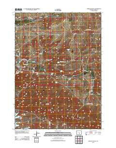
Seminoe Dam NE, Wyoming, USGS topographic map dated 2012.
Includes geographic coordinates (latitude and longitude). This topographic map is suitable for hiking, camping, and exploring, or framing it as a wall map.
Printed on-demand using high resolution imagery, on heavy weight and acid free paper, or alternatively on a variety of synthetic materials.
Topos available on paper, Waterproof, Poly, or Tyvek. Usually shipping rolled, unless combined with other folded maps in one order.
- Product Number: USGS-5656243
- Free digital map download (high-resolution, GeoPDF): Seminoe Dam NE, Wyoming (file size: 22 MB)
- Map Size: please refer to the dimensions of the GeoPDF map above
- Weight (paper map): ca. 55 grams
- Map Type: POD USGS Topographic Map
- Map Series: US Topo
- Map Verison: Historical
- Cell ID: 40541
- Datum: North American Datum of 1983
- Map Projection: Transverse Mercator
- Map Cell Name: Seminoe Dam NE
- Grid size: 7.5 X 7.5 Minute
- Date on map: 2012
- Map Scale: 1:24000
- Geographical region: Wyoming, United States
Neighboring Maps:
All neighboring USGS topo maps are available for sale online at a variety of scales.
Spatial coverage:
Topo map Seminoe Dam NE, Wyoming, covers the geographical area associated the following places:
- Shirley Mountains Area Mine - Kortes Dam Camp - Number Three Gulch - Spencer Draw - Red Spring Draw - Bunker Hill - Nine Bar W Ranch - Wildcat Springs - Seminoe Canyon - Deadman Canyon - Dry Lake - House Gulch - Hurt Gulch - Cow Canyon - Lost Creek School - Indian Spring - Iron Springs Creek - Willow Springs - Threemile Spring - Sage Creek Clubhouse - Cottonwood Creek - Number Two Gulch - Willow Springs Creek - Hamilton Creek - House Gulch Reservoir - Seminoe Mountains - Red Spring - Lost Creek - Sips Spring - Black Canyon Ranch - Hurt Gulch - Vivian Ranch - Number One Gulch - Lost Creek Ranch - Big Draw
- Map Area ID: AREA42.2542.125-106.875-106.75
- Northwest corner Lat/Long code: USGSNW42.25-106.875
- Northeast corner Lat/Long code: USGSNE42.25-106.75
- Southwest corner Lat/Long code: USGSSW42.125-106.875
- Southeast corner Lat/Long code: USGSSE42.125-106.75
- Northern map edge Latitude: 42.25
- Southern map edge Latitude: 42.125
- Western map edge Longitude: -106.875
- Eastern map edge Longitude: -106.75


