
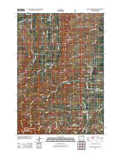
~ Beaver Creek Hills WY topo map, 1:24000 scale, 7.5 X 7.5 Minute, Historical, 2012
Beaver Creek Hills, Wyoming, USGS topographic map dated 2012.
Includes geographic coordinates (latitude and longitude). This topographic map is suitable for hiking, camping, and exploring, or framing it as a wall map.
Printed on-demand using high resolution imagery, on heavy weight and acid free paper, or alternatively on a variety of synthetic materials.
Topos available on paper, Waterproof, Poly, or Tyvek. Usually shipping rolled, unless combined with other folded maps in one order.
- Product Number: USGS-5653932
- Free digital map download (high-resolution, GeoPDF): Beaver Creek Hills, Wyoming (file size: 17 MB)
- Map Size: please refer to the dimensions of the GeoPDF map above
- Weight (paper map): ca. 55 grams
- Map Type: POD USGS Topographic Map
- Map Series: US Topo
- Map Verison: Historical
- Cell ID: 2933
- Datum: North American Datum of 1983
- Map Projection: Transverse Mercator
- Map Cell Name: Beaver Creek Hills
- Grid size: 7.5 X 7.5 Minute
- Date on map: 2012
- Map Scale: 1:24000
- Geographical region: Wyoming, United States
Neighboring Maps:
All neighboring USGS topo maps are available for sale online at a variety of scales.
Spatial coverage:
Topo map Beaver Creek Hills, Wyoming, covers the geographical area associated the following places:
- Jerry Johns Reservoir Number 1 Dam - Bracket Number 3 Reservoir - Red Grade Spring Draw - Big Goose and Beaver Ditch - Alder Gulch - Beaver Creek Hills - Curlew Hill - White Creek - West Fork Davis Creek - East Fork Davis Creek - North Coyote Draw - Bear Gulch - Trabing Creek - Gallatin Draw - Bracket Number 3 Dam - Baker Draw - Colorado Colony Ditch - Ditch Number 9 - Sheridan South Division - Darlington Draw - Hill Creek - Lone Star Creek - Peralta Ditch - W S Draw - Barr Draw - Garber Draw - Apple Run - Hurlburt Creek - Jerry Johns Reservoir Number 1 - South Coyote Draw - Davis Creek - Government Gap
- Map Area ID: AREA44.7544.625-107.125-107
- Northwest corner Lat/Long code: USGSNW44.75-107.125
- Northeast corner Lat/Long code: USGSNE44.75-107
- Southwest corner Lat/Long code: USGSSW44.625-107.125
- Southeast corner Lat/Long code: USGSSE44.625-107
- Northern map edge Latitude: 44.75
- Southern map edge Latitude: 44.625
- Western map edge Longitude: -107.125
- Eastern map edge Longitude: -107


