
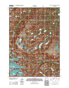
~ Fremont Peak North WY topo map, 1:24000 scale, 7.5 X 7.5 Minute, Historical, 2012
Fremont Peak North, Wyoming, USGS topographic map dated 2012.
Includes geographic coordinates (latitude and longitude). This topographic map is suitable for hiking, camping, and exploring, or framing it as a wall map.
Printed on-demand using high resolution imagery, on heavy weight and acid free paper, or alternatively on a variety of synthetic materials.
Topos available on paper, Waterproof, Poly, or Tyvek. Usually shipping rolled, unless combined with other folded maps in one order.
- Product Number: USGS-5653624
- Free digital map download (high-resolution, GeoPDF): Fremont Peak North, Wyoming (file size: 23 MB)
- Map Size: please refer to the dimensions of the GeoPDF map above
- Weight (paper map): ca. 55 grams
- Map Type: POD USGS Topographic Map
- Map Series: US Topo
- Map Verison: Historical
- Cell ID: 16408
- Datum: North American Datum of 1983
- Map Projection: Transverse Mercator
- Map Cell Name: Fremont Peak North
- Grid size: 7.5 X 7.5 Minute
- Date on map: 2012
- Map Scale: 1:24000
- Geographical region: Wyoming, United States
Neighboring Maps:
All neighboring USGS topo maps are available for sale online at a variety of scales.
Spatial coverage:
Topo map Fremont Peak North, Wyoming, covers the geographical area associated the following places:
- Sacagawea Glacier - Don Lake - Lower Fremont Glacier - Noel Lake - Fourts Horn - Cub Lake - Moose Lake - Backpackers Pass - Elsie Col - Chimney Rock - Upper Fremont Glacier - Wilson Meadows - Blaurock Pass - Horse Ridge - Indian Pass - Turret Peak - Gannett Creek - East Sentinel - Native Lake - Mount Sacagawea - Sunbeam Peak - Heap Steep Peak - Dry Creek Ridge - Mount Febbas - Heap Steep Glacier - Helen Glacier - Klonkike Creek - Fremont Glaciers
- Map Area ID: AREA43.2543.125-109.625-109.5
- Northwest corner Lat/Long code: USGSNW43.25-109.625
- Northeast corner Lat/Long code: USGSNE43.25-109.5
- Southwest corner Lat/Long code: USGSSW43.125-109.625
- Southeast corner Lat/Long code: USGSSE43.125-109.5
- Northern map edge Latitude: 43.25
- Southern map edge Latitude: 43.125
- Western map edge Longitude: -109.625
- Eastern map edge Longitude: -109.5


