
~ Bengough Hill WY topo map, 1:24000 scale, 7.5 X 7.5 Minute, Historical, 2012
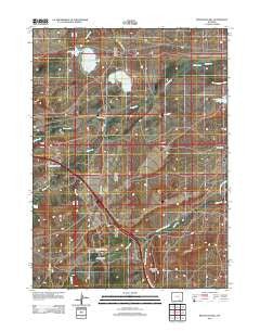
Bengough Hill, Wyoming, USGS topographic map dated 2012.
Includes geographic coordinates (latitude and longitude). This topographic map is suitable for hiking, camping, and exploring, or framing it as a wall map.
Printed on-demand using high resolution imagery, on heavy weight and acid free paper, or alternatively on a variety of synthetic materials.
Topos available on paper, Waterproof, Poly, or Tyvek. Usually shipping rolled, unless combined with other folded maps in one order.
- Product Number: USGS-5646142
- Free digital map download (high-resolution, GeoPDF): Bengough Hill, Wyoming (file size: 17 MB)
- Map Size: please refer to the dimensions of the GeoPDF map above
- Weight (paper map): ca. 55 grams
- Map Type: POD USGS Topographic Map
- Map Series: US Topo
- Map Verison: Historical
- Cell ID: 3327
- Datum: North American Datum of 1983
- Map Projection: Transverse Mercator
- Map Cell Name: Bengough Hill
- Grid size: 7.5 X 7.5 Minute
- Date on map: 2012
- Map Scale: 1:24000
- Geographical region: Wyoming, United States
Neighboring Maps:
All neighboring USGS topo maps are available for sale online at a variety of scales.
Spatial coverage:
Topo map Bengough Hill, Wyoming, covers the geographical area associated the following places:
- Bosler Reservoir - Dutton Creek Oil Field - Seepage Creek - Cooper Cove Oil Field - Beaver Ponds - Bosler Dam - King Number 1 Dam - Bengough Hill - North Fork Cooper Creek - King Number 1 Reservoir - King Reservoir Number 1 - Jimmie Creek - Jankovsky Ranch - Northrop Ditch Number 5 - Northrop Ditch Number 7 - Dunn Ranch - Fry Mine - Seepage Dam - Seepage Reservoir - East Fork Dutton Creek - Terry Mine - Dutton Creek Ditch - McFadden Reservoir Number Three - McFadden Number 3 Dam - South Fork Cooper Creek - J F White Prospect - Sheep Creek - Dutton Creek Reservoir Supply Ditch
- Map Area ID: AREA41.62541.5-106.125-106
- Northwest corner Lat/Long code: USGSNW41.625-106.125
- Northeast corner Lat/Long code: USGSNE41.625-106
- Southwest corner Lat/Long code: USGSSW41.5-106.125
- Southeast corner Lat/Long code: USGSSE41.5-106
- Northern map edge Latitude: 41.625
- Southern map edge Latitude: 41.5
- Western map edge Longitude: -106.125
- Eastern map edge Longitude: -106


