
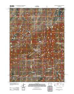
~ Banner Mountain WY topo map, 1:24000 scale, 7.5 X 7.5 Minute, Historical, 2012
Banner Mountain, Wyoming, USGS topographic map dated 2012.
Includes geographic coordinates (latitude and longitude). This topographic map is suitable for hiking, camping, and exploring, or framing it as a wall map.
Printed on-demand using high resolution imagery, on heavy weight and acid free paper, or alternatively on a variety of synthetic materials.
Topos available on paper, Waterproof, Poly, or Tyvek. Usually shipping rolled, unless combined with other folded maps in one order.
- Product Number: USGS-5642829
- Free digital map download (high-resolution, GeoPDF): Banner Mountain, Wyoming (file size: 20 MB)
- Map Size: please refer to the dimensions of the GeoPDF map above
- Weight (paper map): ca. 55 grams
- Map Type: POD USGS Topographic Map
- Map Series: US Topo
- Map Verison: Historical
- Cell ID: 2347
- Datum: North American Datum of 1983
- Map Projection: Transverse Mercator
- Map Cell Name: Banner Mountain
- Grid size: 7.5 X 7.5 Minute
- Date on map: 2012
- Map Scale: 1:24000
- Geographical region: Wyoming, United States
Neighboring Maps:
All neighboring USGS topo maps are available for sale online at a variety of scales.
Spatial coverage:
Topo map Banner Mountain, Wyoming, covers the geographical area associated the following places:
- Davis Ranch - V R Ditch - West Fork Deer Creek - Cardine-Keith Dam - Negro Hill - Steeple Pasture - Davis Creek - Paul Creek - West Fork Deer Creek - Smith Ranch - Red Creek - Nona Creek - Keith Ranch - Lamb Upper Dam - Kimball Ranch - Deer Creek Canyon Chromite Mine - Rissler Ranch - Lamb Upper Reservoir - Koch Deposit Number One - Beaver Creek - Rissler Draw - Agnes Reservoir - Hess Draw - Banner Mountain - Rissler Dam - V R Camp - Koch Deposit - Spring Creek - Rissler Reservoir - Lower Deer Creek Canyon - Skeen Creek - King Creek - V R Ditch - Banner Ranch - Negro Creek Park - Silver State Ditch Number 1 - Deer Creek Park - Smith Creek - Brooks Camp - Phillips Spring - Agnes Dam - Cardine-Keith Reservoir - Duck Creek - Trout Canyon - Portugese Pasture
- Map Area ID: AREA42.7542.625-106.125-106
- Northwest corner Lat/Long code: USGSNW42.75-106.125
- Northeast corner Lat/Long code: USGSNE42.75-106
- Southwest corner Lat/Long code: USGSSW42.625-106.125
- Southeast corner Lat/Long code: USGSSE42.625-106
- Northern map edge Latitude: 42.75
- Southern map edge Latitude: 42.625
- Western map edge Longitude: -106.125
- Eastern map edge Longitude: -106


