
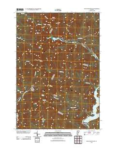
~ Bolton Mountain VT topo map, 1:24000 scale, 7.5 X 7.5 Minute, Historical, 2012
Bolton Mountain, Vermont, USGS topographic map dated 2012.
Includes geographic coordinates (latitude and longitude). This topographic map is suitable for hiking, camping, and exploring, or framing it as a wall map.
Printed on-demand using high resolution imagery, on heavy weight and acid free paper, or alternatively on a variety of synthetic materials.
Topos available on paper, Waterproof, Poly, or Tyvek. Usually shipping rolled, unless combined with other folded maps in one order.
- Product Number: USGS-5641000
- Free digital map download (high-resolution, GeoPDF): Bolton Mountain, Vermont (file size: 23 MB)
- Map Size: please refer to the dimensions of the GeoPDF map above
- Weight (paper map): ca. 55 grams
- Map Type: POD USGS Topographic Map
- Map Series: US Topo
- Map Verison: Historical
- Cell ID: 4753
- Datum: North American Datum of 1983
- Map Projection: Transverse Mercator
- Map Cell Name: Bolton Mountain
- Grid size: 7.5 X 7.5 Minute
- Date on map: 2012
- Map Scale: 1:24000
- Geographical region: Vermont, United States
Neighboring Maps:
All neighboring USGS topo maps are available for sale online at a variety of scales.
Spatial coverage:
Topo map Bolton Mountain, Vermont, covers the geographical area associated the following places:
- Kenyon Sawmill (historical) - Bolton Mountain - Mount Clark - Lake Mansfield - Bryant Lodge - Dalley Loop Trail - Goose Pond - Bolton Valley Ski Area - Mount Mayo - Sugarloaf - WNCS-FM (Montpelier) - Woodward Mountain - Lake Mansfield Dam - Cotton Brook - Sawmill Loop Trail - Hedgehop Hill Loop Trail - Waterbury Dam - Stevenson Brook - Little River State Park - Bone Mountain - Feigel Hill - Waterbury Reservoir - Taylor Lodge - Nebraska Notch - Ricker Mountain - Waterbury Last Block Sawmill - Dewey Mountain - Stevenson Brook Trail - Schoolhouse District 10 School (historical) - Bolton Lodge
- Map Area ID: AREA44.544.375-72.875-72.75
- Northwest corner Lat/Long code: USGSNW44.5-72.875
- Northeast corner Lat/Long code: USGSNE44.5-72.75
- Southwest corner Lat/Long code: USGSSW44.375-72.875
- Southeast corner Lat/Long code: USGSSE44.375-72.75
- Northern map edge Latitude: 44.5
- Southern map edge Latitude: 44.375
- Western map edge Longitude: -72.875
- Eastern map edge Longitude: -72.75


