
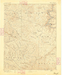
~ Raleigh WV topo map, 1:125000 scale, 30 X 30 Minute, Historical, 1891
Raleigh, West Virginia, USGS topographic map dated 1891.
Includes geographic coordinates (latitude and longitude). This topographic map is suitable for hiking, camping, and exploring, or framing it as a wall map.
Printed on-demand using high resolution imagery, on heavy weight and acid free paper, or alternatively on a variety of synthetic materials.
Topos available on paper, Waterproof, Poly, or Tyvek. Usually shipping rolled, unless combined with other folded maps in one order.
- Product Number: USGS-5638755
- Free digital map download (high-resolution, GeoPDF): Raleigh, West Virginia (file size: 9 MB)
- Map Size: please refer to the dimensions of the GeoPDF map above
- Weight (paper map): ca. 55 grams
- Map Type: POD USGS Topographic Map
- Map Series: HTMC
- Map Verison: Historical
- Cell ID: 395869
- Scan ID: 254005
- Survey Year: 1885
- Datum: Unstated
- Map Projection: Unstated
- Map published by United States Geological Survey
- Map Language: English
- Scanner Resolution: 600 dpi
- Map Cell Name: Raleigh
- Grid size: 30 X 30 Minute
- Date on map: 1891
- Map Scale: 1:125000
- Geographical region: West Virginia, United States
Neighboring Maps:
All neighboring USGS topo maps are available for sale online at a variety of scales.
Spatial coverage:
Topo map Raleigh, West Virginia, covers the geographical area associated the following places:
- Beckley - Rosedale - Sweeneyburg - Hotchkiss - Killarney - Saxon - Joe Branch - Dimmock - Besoco - Coal City - Lee - Export (historical) - Rush Run (historical) - Prince - Royal - Riley - Affinity - Maple Fork - Old Mill Village - Fireco - Itmann - Mabscott - Matville - McGraws - Pickshin - Roseville (historical) - Dothan - Abney - Newfound - Dewitt - Ameagle - Lynwinn - Elmore - Sprague - Prosperity - Pinepoca (historical) - Thurmond - Milam - Otsego - Glen Rogers - Clear Creek - Pemberton - Egeria - Weirwood - Battleship - Cool Ridge - Wickham - Fairdale - Bradley - New Richmond - Glen Daniel - Fire Creek (historical) - Ghent - Grandview - Stonecoal Junction - Norvell (historical) - Sanger - Cabell - Westerly - Mossy - Johnstown - Maynor - Brooklyn - Stotesbury - Pine Hills - Maben - Montecarlo - Skelton - Rhodell - Sylvia (historical) - Princewick - Tams - Midway - Sophia - Cranberry - Concho - Mullens - Wright - Woodbay (historical) - Terry Junction - Greenstown - Epperly - Mount Tabor - Josephine - Raleigh - Flat Top - Big Stick - Pineknob - Glen Jean - Thayer - Dry Hill - United - Rocklick - Masseyville - Cirtsville - Whitby - Redbird - Blackeagle - Take In Hollow - Glade
- Map Area ID: AREA3837.5-81.5-81
- Northwest corner Lat/Long code: USGSNW38-81.5
- Northeast corner Lat/Long code: USGSNE38-81
- Southwest corner Lat/Long code: USGSSW37.5-81.5
- Southeast corner Lat/Long code: USGSSE37.5-81
- Northern map edge Latitude: 38
- Southern map edge Latitude: 37.5
- Western map edge Longitude: -81.5
- Eastern map edge Longitude: -81


