
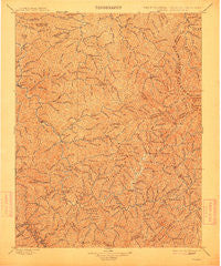
~ Oceana WV topo map, 1:125000 scale, 30 X 30 Minute, Historical, 1898, updated 1912
Oceana, West Virginia, USGS topographic map dated 1898.
Includes geographic coordinates (latitude and longitude). This topographic map is suitable for hiking, camping, and exploring, or framing it as a wall map.
Printed on-demand using high resolution imagery, on heavy weight and acid free paper, or alternatively on a variety of synthetic materials.
Topos available on paper, Waterproof, Poly, or Tyvek. Usually shipping rolled, unless combined with other folded maps in one order.
- Product Number: USGS-5638753
- Free digital map download (high-resolution, GeoPDF): Oceana, West Virginia (file size: 13 MB)
- Map Size: please refer to the dimensions of the GeoPDF map above
- Weight (paper map): ca. 55 grams
- Map Type: POD USGS Topographic Map
- Map Series: HTMC
- Map Verison: Historical
- Cell ID: 395871
- Scan ID: 254003
- Imprint Year: 1912
- Survey Year: 1896
- Datum: Unstated
- Map Projection: Unstated
- Map published by United States Geological Survey
- Map Language: English
- Scanner Resolution: 600 dpi
- Map Cell Name: Oceana
- Grid size: 30 X 30 Minute
- Date on map: 1898
- Map Scale: 1:125000
- Geographical region: West Virginia, United States
Neighboring Maps:
All neighboring USGS topo maps are available for sale online at a variety of scales.
Spatial coverage:
Topo map Oceana, West Virginia, covers the geographical area associated the following places:
- Horsepen (historical) - Deskin Addition - Lynco - Kopperston - Turkey - Wanda - Becco - Lake - Isaban - Eunice - Hatcher - Mohawk - Gordon - Greenview - Hetzel - Havana - Davin - Bruno - Clear Fork - Peach Creek - Gilbert Creek - Robinette - Windom - Coal Valley - Yolyn - Mifflin - Glen Alum - Pettry Bottom - Christian - Bandytown - Amherstdale - Justice Addition - Lanta - Earling - Ethel - Argyle - Hensley Heights - Wyoming City - Rocklick - Huff Junction - Birchton - Bigson - Logan - Saunders - Marthatown - Lacoma - Jeffrey - Packsville - Secoal - Sharples - Crany - Blair - Elk Run Junction - Big Branch - Kelly - Gilbert - Crown - Asco - Steeles - Barrett - Freeze Fork - Brenton - Ikes Fork - Monclo - Mineral City - Rock View - Matheny - Crites - Hanover - Lorado - Echart (historical) - Neibert - Stark - Micco - Bob White - Pardee - Dabney - Jackson - Lillydale - Don - Mullensville - Cyclone - Sodom - Van - Clothier - Dog Patch - Mallory - Sundial - Fanrock - Fort Branch - Rossmore - Crooked Creek - Braeholm - Kohlsaat - West Junction - Pineville - Stickney - Chauncey - Sunbeam - Glen Fork
- Map Area ID: AREA3837.5-82-81.5
- Northwest corner Lat/Long code: USGSNW38-82
- Northeast corner Lat/Long code: USGSNE38-81.5
- Southwest corner Lat/Long code: USGSSW37.5-82
- Southeast corner Lat/Long code: USGSSE37.5-81.5
- Northern map edge Latitude: 38
- Southern map edge Latitude: 37.5
- Western map edge Longitude: -82
- Eastern map edge Longitude: -81.5


