
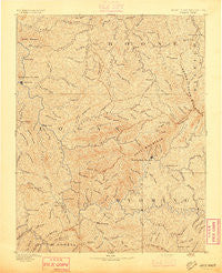
~ Oceana WV topo map, 1:125000 scale, 30 X 30 Minute, Historical, 1893
Oceana, West Virginia, USGS topographic map dated 1893.
Includes geographic coordinates (latitude and longitude). This topographic map is suitable for hiking, camping, and exploring, or framing it as a wall map.
Printed on-demand using high resolution imagery, on heavy weight and acid free paper, or alternatively on a variety of synthetic materials.
Topos available on paper, Waterproof, Poly, or Tyvek. Usually shipping rolled, unless combined with other folded maps in one order.
- Product Number: USGS-5638745
- Free digital map download (high-resolution, GeoPDF): Oceana, West Virginia (file size: 11 MB)
- Map Size: please refer to the dimensions of the GeoPDF map above
- Weight (paper map): ca. 55 grams
- Map Type: POD USGS Topographic Map
- Map Series: HTMC
- Map Verison: Historical
- Cell ID: 395871
- Scan ID: 253999
- Survey Year: 1884
- Datum: Unstated
- Map Projection: Unstated
- Map published by United States Geological Survey
- Map Language: English
- Scanner Resolution: 600 dpi
- Map Cell Name: Oceana
- Grid size: 30 X 30 Minute
- Date on map: 1893
- Map Scale: 1:125000
- Geographical region: West Virginia, United States
Neighboring Maps:
All neighboring USGS topo maps are available for sale online at a variety of scales.
Spatial coverage:
Topo map Oceana, West Virginia, covers the geographical area associated the following places:
- Clear Fork - Ottawa - Gilbert Creek - Steeles - Greenwood - Lundale - Ralumco - Gilbert - Landville - Henlawson - Barrett - Pineville - Wharncliffe - Bruno - Lanta - Mullensville - Slabtown - Fanny - Mohawk - Rum Junction - Superior Bottom - Janie - Red Campbell - Sundial - Sharples - Becco - Gordon - Cazy - Switzer - Fanrock - Crown - Sunbeam - Five Block - Leevale - Claypool - Glover - Latrobe - Christian - Marianna - Baisden - Bigson - Robinette - Kelly - Marfork - Glen Alum - Gillman Bottom - Glen Alum Junction - Ramage - Lincoln - Blair - Crany - Longpole - Ethel - Lyburn - Rita - Spruce Valley - Jesse - Emmett - Chauncey - Crooked Creek - Birchton - Combs Addition - Guyan Terrace - Peach Creek - Deskin Addition - Blue Pennant - Coal Mountain - Anchor - Jarrolds Valley - Wyoming - Taplin - Wylo - Sharon Heights - Hutchinson - Toney Fork - Orville - Rossmore - Sun Hill - Fort Branch - Stickney - North Mitchell Heights - Pecks Mill - Sodom - Davin - Slagle - Chambers - Big Branch - Manila - Cub City - Lindytown - Justice - Freeze Fork - Fanco - Lake - Windom - Craneco - Stoneville - Hetzel - Huff Junction - Greenview
- Map Area ID: AREA3837.5-82-81.5
- Northwest corner Lat/Long code: USGSNW38-82
- Northeast corner Lat/Long code: USGSNE38-81.5
- Southwest corner Lat/Long code: USGSSW37.5-82
- Southeast corner Lat/Long code: USGSSE37.5-81.5
- Northern map edge Latitude: 38
- Southern map edge Latitude: 37.5
- Western map edge Longitude: -82
- Eastern map edge Longitude: -81.5


