
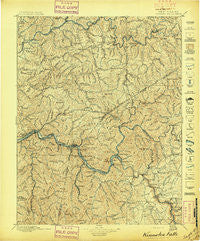
~ Kanawha Falls WV topo map, 1:125000 scale, 30 X 30 Minute, Historical, 1897
Kanawha Falls, West Virginia, USGS topographic map dated 1897.
Includes geographic coordinates (latitude and longitude). This topographic map is suitable for hiking, camping, and exploring, or framing it as a wall map.
Printed on-demand using high resolution imagery, on heavy weight and acid free paper, or alternatively on a variety of synthetic materials.
Topos available on paper, Waterproof, Poly, or Tyvek. Usually shipping rolled, unless combined with other folded maps in one order.
- Product Number: USGS-5638723
- Free digital map download (high-resolution, GeoPDF): Kanawha Falls, West Virginia (file size: 13 MB)
- Map Size: please refer to the dimensions of the GeoPDF map above
- Weight (paper map): ca. 55 grams
- Map Type: POD USGS Topographic Map
- Map Series: HTMC
- Map Verison: Historical
- Cell ID: 395870
- Scan ID: 253984
- Survey Year: 1895
- Datum: Unstated
- Map Projection: Unstated
- Map published by United States Geological Survey
- Map Language: English
- Scanner Resolution: 600 dpi
- Map Cell Name: Kanawha Falls
- Grid size: 30 X 30 Minute
- Date on map: 1897
- Map Scale: 1:125000
- Geographical region: West Virginia, United States
Neighboring Maps:
All neighboring USGS topo maps are available for sale online at a variety of scales.
Spatial coverage:
Topo map Kanawha Falls, West Virginia, covers the geographical area associated the following places:
- Kayford - Crescent - Odessa - South Caperton - Fayette Heights - Falling Rock - Gamoca - Ramsey - Hamilton (historical) - Quick - Hawks Nest - Midway - Rensford - Beckwith - Cinco - Acup - Odell - Mount Carbon - Osborne - Leander - Upper Leatherwood - Clendenin - Oak Ridge - Grayden - Chelyan - Collinsdale - Hamilton - Triplett - Peters Junction - MacDougal - Harewood - Donwood - Jarretts Ford - Swiss - Fivemile - Hitop - Turner - West Montgomery - Giles - Riverside - Queen Shoals - Carbon - Wriston - Belva - Vaughan - Shrewsbury - Cabin Creek - South Nuttall (historical) - KM Junction - Gallagher - Kincaid - Albion (historical) - Blue Creek - Smithers - Hico - Hollygrove - Annfred - Greencastle - Marne - Hugheston - Pratt - Page - Heatherman (historical) - Romont - Chimney Corner - Lockwood - Elkview - Acme - Deep Water - Hopewell - Hartland - Porter - Adonijah - Beauty - Pine Grove - Ingram Branch - Procious - London - Red Warrior - Ohley - Lizemores - Ames Heights - Three Mile - Kimberly - Carbondale - Clay Junction - Pentacre - McDunn - Elverton - Glen Ferris - Two Run - Dundon - Livingston - Alloy - Burnwell - Morocco (historical) - Wills - Beech Glen - Vanetta - Beards Fork
- Map Area ID: AREA38.538-81.5-81
- Northwest corner Lat/Long code: USGSNW38.5-81.5
- Northeast corner Lat/Long code: USGSNE38.5-81
- Southwest corner Lat/Long code: USGSSW38-81.5
- Southeast corner Lat/Long code: USGSSE38-81
- Northern map edge Latitude: 38.5
- Southern map edge Latitude: 38
- Western map edge Longitude: -81.5
- Eastern map edge Longitude: -81


