
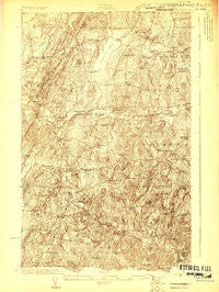
~ Franklin Pond VT topo map, 1:48000 scale, 15 X 15 Minute, Historical, 1922
Franklin Pond, Vermont, USGS topographic map dated 1922.
Includes geographic coordinates (latitude and longitude). This topographic map is suitable for hiking, camping, and exploring, or framing it as a wall map.
Printed on-demand using high resolution imagery, on heavy weight and acid free paper, or alternatively on a variety of synthetic materials.
Topos available on paper, Waterproof, Poly, or Tyvek. Usually shipping rolled, unless combined with other folded maps in one order.
- Product Number: USGS-5638503
- Free digital map download (high-resolution, GeoPDF): Franklin Pond, Vermont (file size: 18 MB)
- Map Size: please refer to the dimensions of the GeoPDF map above
- Weight (paper map): ca. 55 grams
- Map Type: POD USGS Topographic Map
- Map Series: HTMC
- Map Verison: Historical
- Cell ID: 53923
- Scan ID: 337797
- Survey Year: 1922
- Datum: NAD
- Map Projection: Polyconic
- Advance: Yes
- Map published by United States Geological Survey
- Map published by United States Army Corps of Engineers
- Keywords: Overedge; Nonstandard Press Run
- Map Language: English
- Scanner Resolution: 600 dpi
- Map Cell Name: Enosburg Falls
- Grid size: 15 X 15 Minute
- Date on map: 1922
- Map Scale: 1:48000
- Geographical region: Vermont, United States
Neighboring Maps:
All neighboring USGS topo maps are available for sale online at a variety of scales.
Spatial coverage:
Topo map Franklin Pond, Vermont, covers the geographical area associated the following places:
- West Enosburg - North Sheldon - Sheldon Springs - West Berkshire - South Franklin - Enosburg Center - East Fairfield - Bordoville - Beattys Four Corners - North Enosburg - South Franklin - Shawville - Berkshire - East Highgate - Enosburg Falls - East Franklin - Franklin - Gilberts Tannery - Browns Corners - Bakersfield - Sheldon - Camp Grounds - Saint Rocks - Fairfield - Sheldon Junction - East Sheldon
- Map Area ID: AREA4544.75-73-72.75
- Northwest corner Lat/Long code: USGSNW45-73
- Northeast corner Lat/Long code: USGSNE45-72.75
- Southwest corner Lat/Long code: USGSSW44.75-73
- Southeast corner Lat/Long code: USGSSE44.75-72.75
- Northern map edge Latitude: 45
- Southern map edge Latitude: 44.75
- Western map edge Longitude: -73
- Eastern map edge Longitude: -72.75


