
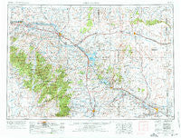
~ Torrington WY topo map, 1:250000 scale, 1 X 2 Degree, Historical, 1954, updated 1976
Torrington, Wyoming, USGS topographic map dated 1954.
Includes geographic coordinates (latitude and longitude). This topographic map is suitable for hiking, camping, and exploring, or framing it as a wall map.
Printed on-demand using high resolution imagery, on heavy weight and acid free paper, or alternatively on a variety of synthetic materials.
Topos available on paper, Waterproof, Poly, or Tyvek. Usually shipping rolled, unless combined with other folded maps in one order.
- Product Number: USGS-5618076
- Free digital map download (high-resolution, GeoPDF): Torrington, Wyoming (file size: 19 MB)
- Map Size: please refer to the dimensions of the GeoPDF map above
- Weight (paper map): ca. 55 grams
- Map Type: POD USGS Topographic Map
- Map Series: HTMC
- Map Verison: Historical
- Cell ID: 69057
- Scan ID: 342619
- Imprint Year: 1976
- Woodland Tint: Yes
- Aerial Photo Year: 1974
- Edit Year: 1975
- Field Check Year: 1954
- Datum: Unstated
- Map Projection: Transverse Mercator
- Map published by: Military, Other
- Map Language: English
- Scanner Resolution: 600 dpi
- Map Cell Name: Torrington
- Grid size: 1 X 2 Degree
- Date on map: 1954
- Map Scale: 1:250000
- Geographical region: Wyoming, United States
Neighboring Maps:
All neighboring USGS topo maps are available for sale online at a variety of scales.
Spatial coverage:
Topo map Torrington, Wyoming, covers the geographical area associated the following places:
- Point of Rocks - Douglas - Westview Circle - Deadmans Corner - Whitman - Leahy Place - Guernsey - Fort Laramie - Shawnee - Orpha - South Torrington - Y-O Ranch - Meadowdale - Wheatland - Toltec - Irvine Home Trust Retirement Homes - Van Tassell - Sibylee - Little Medicine - Glendo - Jay Em - Lusk - Cottier - Heldt - Chugcreek - Reed Place - Hat Creek (historical) - Cassa - Esterbrook - Sunrise - Gibson - Hartville - Ammon - Kirtley - Rolling Hills - Irvine - Rockeagle - Squaw Place - Lost Springs - Boxelder - Uva - Parkerton - Orin - Curtis - Glenrock - Lingle - Torrington - Dwyer - Wendover - Keeline - Orin Junction - Clayton - Whiting - Binford - Manville - Buck Place - Dwyer Junction
- Map Area ID: AREA4342-106-104
- Northwest corner Lat/Long code: USGSNW43-106
- Northeast corner Lat/Long code: USGSNE43-104
- Southwest corner Lat/Long code: USGSSW42-106
- Southeast corner Lat/Long code: USGSSE42-104
- Northern map edge Latitude: 43
- Southern map edge Latitude: 42
- Western map edge Longitude: -106
- Eastern map edge Longitude: -104


