
~ Sheridan WY topo map, 1:250000 scale, 1 X 2 Degree, Historical, 1962, updated 1962
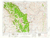
Sheridan, Wyoming, USGS topographic map dated 1962.
Includes geographic coordinates (latitude and longitude). This topographic map is suitable for hiking, camping, and exploring, or framing it as a wall map.
Printed on-demand using high resolution imagery, on heavy weight and acid free paper, or alternatively on a variety of synthetic materials.
Topos available on paper, Waterproof, Poly, or Tyvek. Usually shipping rolled, unless combined with other folded maps in one order.
- Product Number: USGS-5618056
- Free digital map download (high-resolution, GeoPDF): Sheridan, Wyoming (file size: 22 MB)
- Map Size: please refer to the dimensions of the GeoPDF map above
- Weight (paper map): ca. 55 grams
- Map Type: POD USGS Topographic Map
- Map Series: HTMC
- Map Verison: Historical
- Cell ID: 69027
- Scan ID: 342609
- Imprint Year: 1962
- Woodland Tint: Yes
- Field Check Year: 1955
- Datum: Unstated
- Map Projection: Transverse Mercator
- Map published by United States Army Corps of Engineers
- Map published by United States Army
- Map Language: English
- Scanner Resolution: 600 dpi
- Map Cell Name: Sheridan
- Grid size: 1 X 2 Degree
- Date on map: 1962
- Map Scale: 1:250000
- Geographical region: Wyoming, United States
Neighboring Maps:
All neighboring USGS topo maps are available for sale online at a variety of scales.
Spatial coverage:
Topo map Sheridan, Wyoming, covers the geographical area associated the following places:
- Kendrick - Eccles - Sheridan - Burgess Junction - Kleenburn - Worland - Big Horn - West River - Buffalo - Ulm - Acme - Hyattville - Reeves Corner - Hazelton - Monarch - Story - Leiter - Shell - Ucross - Meadow Lark Lake - Washakie Ten - Flitners Corner - Wolf - Wyarno - Ranchester - Clearmont - Ten Sleep - Dayton - Manderson - Verona - Saddlestring - Arvada - Kearny - Parkman - Durkee - Beckton - Banner
- Map Area ID: AREA4544-108-106
- Northwest corner Lat/Long code: USGSNW45-108
- Northeast corner Lat/Long code: USGSNE45-106
- Southwest corner Lat/Long code: USGSSW44-108
- Southeast corner Lat/Long code: USGSSE44-106
- Northern map edge Latitude: 45
- Southern map edge Latitude: 44
- Western map edge Longitude: -108
- Eastern map edge Longitude: -106


