
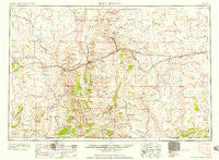
~ Rock Springs WY topo map, 1:250000 scale, 1 X 2 Degree, Historical, 1958, updated 1958
Rock Springs, Wyoming, USGS topographic map dated 1958.
Includes geographic coordinates (latitude and longitude). This topographic map is suitable for hiking, camping, and exploring, or framing it as a wall map.
Printed on-demand using high resolution imagery, on heavy weight and acid free paper, or alternatively on a variety of synthetic materials.
Topos available on paper, Waterproof, Poly, or Tyvek. Usually shipping rolled, unless combined with other folded maps in one order.
- Product Number: USGS-5618040
- Free digital map download (high-resolution, GeoPDF): Rock Springs, Wyoming (file size: 16 MB)
- Map Size: please refer to the dimensions of the GeoPDF map above
- Weight (paper map): ca. 55 grams
- Map Type: POD USGS Topographic Map
- Map Series: HTMC
- Map Verison: Historical
- Cell ID: 72244
- Scan ID: 342601
- Imprint Year: 1958
- Woodland Tint: Yes
- Field Check Year: 1954
- Datum: Unstated
- Map Projection: Transverse Mercator
- Map published by United States Army Corps of Engineers
- Map published by United States Army
- Map Language: English
- Scanner Resolution: 600 dpi
- Map Cell Name: Rock Springs
- Grid size: 1 X 2 Degree
- Date on map: 1958
- Map Scale: 1:250000
- Geographical region: Wyoming, United States
Neighboring Maps:
All neighboring USGS topo maps are available for sale online at a variety of scales.
Spatial coverage:
Topo map Rock Springs, Wyoming, covers the geographical area associated the following places:
- Dines (historical) - Reliance - Tipton - McKinnon - Granger - Kanda - Greenhough Place - Bitter Creek - Stansbury - Point of Rocks - Table Rock - Sweeney Ranch - Little America - Purple Sage - Monell - Thayer Junction - James Town - Granger Junction - South Superior - Riovista - J O Junction - Quealy - Washam - Robinson - Arrowhead Springs - Bryan - South Baxter - Salt Wells - Petes Place - Clearview Acres - Blairtown - Green River - Rock Springs - Squaw Hollow (historical) - Rendezvous - Fort LaClede (historical) - Winton (historical) - Red Desert - North Rock Springs
- Map Area ID: AREA4241-110-108
- Northwest corner Lat/Long code: USGSNW42-110
- Northeast corner Lat/Long code: USGSNE42-108
- Southwest corner Lat/Long code: USGSSW41-110
- Southeast corner Lat/Long code: USGSSE41-108
- Northern map edge Latitude: 42
- Southern map edge Latitude: 41
- Western map edge Longitude: -110
- Eastern map edge Longitude: -108


