
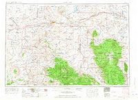
~ Rawlins WY topo map, 1:250000 scale, 1 X 2 Degree, Historical, 1954, updated 1968
Rawlins, Wyoming, USGS topographic map dated 1954.
Includes geographic coordinates (latitude and longitude). This topographic map is suitable for hiking, camping, and exploring, or framing it as a wall map.
Printed on-demand using high resolution imagery, on heavy weight and acid free paper, or alternatively on a variety of synthetic materials.
Topos available on paper, Waterproof, Poly, or Tyvek. Usually shipping rolled, unless combined with other folded maps in one order.
- Product Number: USGS-5618030
- Free digital map download (high-resolution, GeoPDF): Rawlins, Wyoming (file size: 17 MB)
- Map Size: please refer to the dimensions of the GeoPDF map above
- Weight (paper map): ca. 55 grams
- Map Type: POD USGS Topographic Map
- Map Series: HTMC
- Map Verison: Historical
- Cell ID: 68985
- Scan ID: 342597
- Imprint Year: 1968
- Woodland Tint: Yes
- Edit Year: 1962
- Field Check Year: 1954
- Datum: Unstated
- Map Projection: Transverse Mercator
- Map published by United States Army Corps of Engineers
- Map published by United States Army
- Map Language: English
- Scanner Resolution: 600 dpi
- Map Cell Name: Rawlins
- Grid size: 1 X 2 Degree
- Date on map: 1954
- Map Scale: 1:250000
- Geographical region: Wyoming, United States
Neighboring Maps:
All neighboring USGS topo maps are available for sale online at a variety of scales.
Spatial coverage:
Topo map Rawlins, Wyoming, covers the geographical area associated the following places:
- Fort Steele - Ivans Grove (historical) - Wamsutter - Old Haymaker Place - Tullis - Medicine Bow - Collins (historical) - Tenmile - Creston Junction - Milo - Creston - Woodedge - Saratoga - Riner - Elk Mountain - Keystone - Wyocolo - Carbon - Morrisey (historical) - Elmo - Sampo (historical) - Sinclair - Dixon - Jays Roost - Oil Springs - Encampment - Dillon (historical) - Albany - Savery - Deerwood - Coyote Springs - Rawlins - Battle (historical) - Baggs - Gramm - Rambler (historical) - Rudefeha (historical) - Edson - Copperton (historical) - Woods Landing - Walcott - Mountain Home - Arlington - Foxpark - Old McKeal Place - Elwood (historical) - Dexterville (historical) - Hanna - New Jelm - Riverside - Jelm - Widdowfield (historical) - Battle Creek - Ryan Park - Old Brooks Place - Centennial - McFadden
- Map Area ID: AREA4241-108-106
- Northwest corner Lat/Long code: USGSNW42-108
- Northeast corner Lat/Long code: USGSNE42-106
- Southwest corner Lat/Long code: USGSSW41-108
- Southeast corner Lat/Long code: USGSSE41-106
- Northern map edge Latitude: 42
- Southern map edge Latitude: 41
- Western map edge Longitude: -108
- Eastern map edge Longitude: -106


