
~ Casper WY topo map, 1:250000 scale, 1 X 2 Degree, Historical, 1958, updated 1958
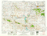
Casper, Wyoming, USGS topographic map dated 1958.
Includes geographic coordinates (latitude and longitude). This topographic map is suitable for hiking, camping, and exploring, or framing it as a wall map.
Printed on-demand using high resolution imagery, on heavy weight and acid free paper, or alternatively on a variety of synthetic materials.
Topos available on paper, Waterproof, Poly, or Tyvek. Usually shipping rolled, unless combined with other folded maps in one order.
- Product Number: USGS-5617976
- Free digital map download (high-resolution, GeoPDF): Casper, Wyoming (file size: 19 MB)
- Map Size: please refer to the dimensions of the GeoPDF map above
- Weight (paper map): ca. 55 grams
- Map Type: POD USGS Topographic Map
- Map Series: HTMC
- Map Verison: Historical
- Cell ID: 68705
- Scan ID: 342570
- Imprint Year: 1958
- Woodland Tint: Yes
- Visual Version Number: 1
- Field Check Year: 1955
- Datum: Unstated
- Map Projection: Transverse Mercator
- Map published by United States Army Corps of Engineers
- Map published by United States Army
- Map Language: English
- Scanner Resolution: 600 dpi
- Map Cell Name: Casper
- Grid size: 1 X 2 Degree
- Date on map: 1958
- Map Scale: 1:250000
- Geographical region: Wyoming, United States
Neighboring Maps:
All neighboring USGS topo maps are available for sale online at a variety of scales.
Spatial coverage:
Topo map Casper, Wyoming, covers the geographical area associated the following places:
- Bessemer Bend - Goose Egg - Bessemer (historical) - Crimson Dawn - Bairoil - Brookhurst - Richardson Acres - Air Base Acres - Alcova Po - Paradise - Casper - Shirley (historical) - Meadow Acres - Strouds - Lamont - Raderville - Red Butte - Marvin Place (historical) - Thorndale Acres - Midwest Heights - Jeffrey City - Leo - Allendale - Evansville - Mills - Three Forks - Red Buttes Village - Muddy Gap - Homa Hills - Paradise Valley - Casper Mountain - Seminoe Dam - Alcova - Hartrandt - Bar Nunn - Eadsville (historical) - McCargar Place - Cow Hollow - Ferris (historical) - Mountain View - Vista West - Bishop
- Map Area ID: AREA4342-108-106
- Northwest corner Lat/Long code: USGSNW43-108
- Northeast corner Lat/Long code: USGSNE43-106
- Southwest corner Lat/Long code: USGSSW42-108
- Southeast corner Lat/Long code: USGSSE42-106
- Northern map edge Latitude: 43
- Southern map edge Latitude: 42
- Western map edge Longitude: -108
- Eastern map edge Longitude: -106


