
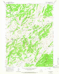
~ Windy Peak WY topo map, 1:24000 scale, 7.5 X 7.5 Minute, Historical, 1964, updated 1968
Windy Peak, Wyoming, USGS topographic map dated 1964.
Includes geographic coordinates (latitude and longitude). This topographic map is suitable for hiking, camping, and exploring, or framing it as a wall map.
Printed on-demand using high resolution imagery, on heavy weight and acid free paper, or alternatively on a variety of synthetic materials.
Topos available on paper, Waterproof, Poly, or Tyvek. Usually shipping rolled, unless combined with other folded maps in one order.
- Product Number: USGS-5616930
- Free digital map download (high-resolution, GeoPDF): Windy Peak, Wyoming (file size: 11 MB)
- Map Size: please refer to the dimensions of the GeoPDF map above
- Weight (paper map): ca. 55 grams
- Map Type: POD USGS Topographic Map
- Map Series: HTMC
- Map Verison: Historical
- Cell ID: 49440
- Scan ID: 341956
- Imprint Year: 1968
- Woodland Tint: Yes
- Aerial Photo Year: 1963
- Field Check Year: 1964
- Datum: NAD27
- Map Projection: Polyconic
- Map published by United States Geological Survey
- Map Language: English
- Scanner Resolution: 600 dpi
- Map Cell Name: Windy Peak
- Grid size: 7.5 X 7.5 Minute
- Date on map: 1964
- Map Scale: 1:24000
- Geographical region: Wyoming, United States
Neighboring Maps:
All neighboring USGS topo maps are available for sale online at a variety of scales.
Spatial coverage:
Topo map Windy Peak, Wyoming, covers the geographical area associated the following places:
- Jackrabbit Creek - Happy Creek - Jaybird Peak - Nine Draw - Buzzard Creek - Slick Mountain - Beaver Mountain - Bell Creek - Bell Hill - Stove Draw - Bell and Scranton Number 2 Dam - Shepherd Springs - Devils Pass - Stratton Creek - Sheldon Creek - Poor Mans Peak - Thirtytwo Creek - Eagle Mountain - Bar M Mountain - Bell and Scranton Number 2 Reservoir - Bouncing Rock - Pugilist Gulch - Graveyard Hill - Monday Creek - Trethway Mountain - Silver Tip Creek - Beaver Creek - Grouse Creek - The Needles - Wagon Wheel Spring - Bell Mountain - Bell Butte - South Horseshoe Creek - Eagle Peak - Buzzard Peak - Prager School - Camp Creek - Sawtooth Ridge - Windy Peak - Skunk Creek - North Horseshoe Creek - Bobcat Creek - Porcupine Creek - Windy Creek - Thirtytwo Canyon - East Windy Creek
- Map Area ID: AREA42.37542.25-105.625-105.5
- Northwest corner Lat/Long code: USGSNW42.375-105.625
- Northeast corner Lat/Long code: USGSNE42.375-105.5
- Southwest corner Lat/Long code: USGSSW42.25-105.625
- Southeast corner Lat/Long code: USGSSE42.25-105.5
- Northern map edge Latitude: 42.375
- Southern map edge Latitude: 42.25
- Western map edge Longitude: -105.625
- Eastern map edge Longitude: -105.5


