
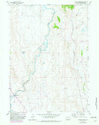
~ Warren Bridge WY topo map, 1:24000 scale, 7.5 X 7.5 Minute, Historical, 1966, updated 1982
Warren Bridge, Wyoming, USGS topographic map dated 1966.
Includes geographic coordinates (latitude and longitude). This topographic map is suitable for hiking, camping, and exploring, or framing it as a wall map.
Printed on-demand using high resolution imagery, on heavy weight and acid free paper, or alternatively on a variety of synthetic materials.
Topos available on paper, Waterproof, Poly, or Tyvek. Usually shipping rolled, unless combined with other folded maps in one order.
- Product Number: USGS-5616748
- Free digital map download (high-resolution, GeoPDF): Warren Bridge, Wyoming (file size: 9 MB)
- Map Size: please refer to the dimensions of the GeoPDF map above
- Weight (paper map): ca. 55 grams
- Map Type: POD USGS Topographic Map
- Map Series: HTMC
- Map Verison: Historical
- Cell ID: 47519
- Scan ID: 341868
- Imprint Year: 1982
- Woodland Tint: Yes
- Photo Revision Year: 1982
- Aerial Photo Year: 1979
- Edit Year: 1982
- Field Check Year: 1966
- Datum: NAD27
- Map Projection: Polyconic
- Map published by United States Geological Survey
- Map Language: English
- Scanner Resolution: 600 dpi
- Map Cell Name: Warren Bridge
- Grid size: 7.5 X 7.5 Minute
- Date on map: 1966
- Map Scale: 1:24000
- Geographical region: Wyoming, United States
Neighboring Maps:
All neighboring USGS topo maps are available for sale online at a variety of scales.
Spatial coverage:
Topo map Warren Bridge, Wyoming, covers the geographical area associated the following places:
- Warren Bridge - Five Eighty-two Pit Number Two Mine - Bickel Ditch - Canyon Ditch - Pine Grove Ditch - Daylite Pit Mine - Wardell Pit Mine - Marsh Creek Pit Mine - Forty Rod Flat Well - Buds Pit Mine - Franz Reservoir - Rexs Pit Mine - Alexander Family Cemetery - L L Pit Mine - Spring Creek - Pinedale Division - Pocket Pit Mine - Que Pit Mine - Horsefly Ditch - The Narrows - Marsh Creek - Five Thirty-two Pit Number One Mine
- Map Area ID: AREA43.12543-110.125-110
- Northwest corner Lat/Long code: USGSNW43.125-110.125
- Northeast corner Lat/Long code: USGSNE43.125-110
- Southwest corner Lat/Long code: USGSSW43-110.125
- Southeast corner Lat/Long code: USGSSE43-110
- Northern map edge Latitude: 43.125
- Southern map edge Latitude: 43
- Western map edge Longitude: -110.125
- Eastern map edge Longitude: -110


