
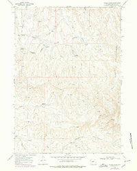
~ Wagon Prong WY topo map, 1:24000 scale, 7.5 X 7.5 Minute, Historical, 1966, updated 1978
Wagon Prong, Wyoming, USGS topographic map dated 1966.
Includes geographic coordinates (latitude and longitude). This topographic map is suitable for hiking, camping, and exploring, or framing it as a wall map.
Printed on-demand using high resolution imagery, on heavy weight and acid free paper, or alternatively on a variety of synthetic materials.
Topos available on paper, Waterproof, Poly, or Tyvek. Usually shipping rolled, unless combined with other folded maps in one order.
- Product Number: USGS-5616660
- Free digital map download (high-resolution, GeoPDF): Wagon Prong, Wyoming (file size: 12 MB)
- Map Size: please refer to the dimensions of the GeoPDF map above
- Weight (paper map): ca. 55 grams
- Map Type: POD USGS Topographic Map
- Map Series: HTMC
- Map Verison: Historical
- Cell ID: 47136
- Scan ID: 341824
- Imprint Year: 1978
- Photo Revision Year: 1978
- Aerial Photo Year: 1976
- Edit Year: 1978
- Field Check Year: 1966
- Datum: NAD27
- Map Projection: Polyconic
- Map published by United States Geological Survey
- Map Language: English
- Scanner Resolution: 600 dpi
- Map Cell Name: Wagon Prong
- Grid size: 7.5 X 7.5 Minute
- Date on map: 1966
- Map Scale: 1:24000
- Geographical region: Wyoming, United States
Neighboring Maps:
All neighboring USGS topo maps are available for sale online at a variety of scales.
Spatial coverage:
Topo map Wagon Prong, Wyoming, covers the geographical area associated the following places:
- Ray Dam - Shortys Reservoir - Hayes Reservoir - Hayes Cow Camp - Meleskie Camp - Little Joe Detention Dam - Rays Detention Dam - Wagon Prong - Hampton Reservoir Number 5 - Little Joe Dam - Antelope Draw - Hampton Reservoir Number 12 - Hampton Well Number 2 - Davis Reservoir Number 2 - Black Mountain Draw - Coal Draw - Ray Reservoir - Nugget Reservoir - Two Wash Dam - No Water Mine - Scorpion Draw - Wagon Prong Reservoir - Little Joe Reservoir - Two Wash Detention Dam - Two Wash Reservoir - Hampton Dam - Old Quaker Reservoir - West Reservoir - The Seeps - Devils Slide
- Map Area ID: AREA43.87543.75-107.75-107.625
- Northwest corner Lat/Long code: USGSNW43.875-107.75
- Northeast corner Lat/Long code: USGSNE43.875-107.625
- Southwest corner Lat/Long code: USGSSW43.75-107.75
- Southeast corner Lat/Long code: USGSSE43.75-107.625
- Northern map edge Latitude: 43.875
- Southern map edge Latitude: 43.75
- Western map edge Longitude: -107.75
- Eastern map edge Longitude: -107.625


