
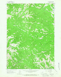
~ Teton Pass WY topo map, 1:24000 scale, 7.5 X 7.5 Minute, Historical, 1963, updated 1966
Teton Pass, Wyoming, USGS topographic map dated 1963.
Includes geographic coordinates (latitude and longitude). This topographic map is suitable for hiking, camping, and exploring, or framing it as a wall map.
Printed on-demand using high resolution imagery, on heavy weight and acid free paper, or alternatively on a variety of synthetic materials.
Topos available on paper, Waterproof, Poly, or Tyvek. Usually shipping rolled, unless combined with other folded maps in one order.
- Product Number: USGS-5616286
- Free digital map download (high-resolution, GeoPDF): Teton Pass, Wyoming (file size: 12 MB)
- Map Size: please refer to the dimensions of the GeoPDF map above
- Weight (paper map): ca. 55 grams
- Map Type: POD USGS Topographic Map
- Map Series: HTMC
- Map Verison: Historical
- Cell ID: 44633
- Scan ID: 341641
- Imprint Year: 1966
- Woodland Tint: Yes
- Aerial Photo Year: 1962
- Field Check Year: 1963
- Datum: NAD27
- Map Projection: Polyconic
- Map published by United States Geological Survey
- Map Language: English
- Scanner Resolution: 600 dpi
- Map Cell Name: Teton Pass
- Grid size: 7.5 X 7.5 Minute
- Date on map: 1963
- Map Scale: 1:24000
- Geographical region: Wyoming, United States
Neighboring Maps:
All neighboring USGS topo maps are available for sale online at a variety of scales.
Spatial coverage:
Topo map Teton Pass, Wyoming, covers the geographical area associated the following places:
- Wilson Census Designated Place - Elliott Cemetery - North Fork Trail Creek - Black Canyon - Teton Pass - Elk Gulch - Crater Lake - Taylor Mountain - Smoky Hollow - Marshall Creek - Glory Slide - Jackson Hole Fire and Emergency Medical Services Station 2 Wilson - Mud Pass - Trail Creek Ranch - Lee Guard Station - Smoky Hollow Peak - Moose Gulch - Fish Creek - Wilson South Pit and Plant Mine - Mill Creek - North Fork Mosquito Creek - Green Knoll
- Map Area ID: AREA43.543.375-111-110.875
- Northwest corner Lat/Long code: USGSNW43.5-111
- Northeast corner Lat/Long code: USGSNE43.5-110.875
- Southwest corner Lat/Long code: USGSSW43.375-111
- Southeast corner Lat/Long code: USGSSE43.375-110.875
- Northern map edge Latitude: 43.5
- Southern map edge Latitude: 43.375
- Western map edge Longitude: -111
- Eastern map edge Longitude: -110.875


