
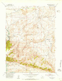
~ Seminoe Dam NE WY topo map, 1:24000 scale, 7.5 X 7.5 Minute, Historical, 1953, updated 1955
Seminoe Dam NE, Wyoming, USGS topographic map dated 1953.
Includes geographic coordinates (latitude and longitude). This topographic map is suitable for hiking, camping, and exploring, or framing it as a wall map.
Printed on-demand using high resolution imagery, on heavy weight and acid free paper, or alternatively on a variety of synthetic materials.
Topos available on paper, Waterproof, Poly, or Tyvek. Usually shipping rolled, unless combined with other folded maps in one order.
- Product Number: USGS-5615564
- Free digital map download (high-resolution, GeoPDF): Seminoe Dam NE, Wyoming (file size: 14 MB)
- Map Size: please refer to the dimensions of the GeoPDF map above
- Weight (paper map): ca. 55 grams
- Map Type: POD USGS Topographic Map
- Map Series: HTMC
- Map Verison: Historical
- Cell ID: 40541
- Scan ID: 341287
- Imprint Year: 1955
- Woodland Tint: Yes
- Aerial Photo Year: 1949
- Field Check Year: 1953
- Datum: NAD27
- Map Projection: Polyconic
- Map published by United States Geological Survey
- Map Language: English
- Scanner Resolution: 600 dpi
- Map Cell Name: Seminoe Dam NE
- Grid size: 7.5 X 7.5 Minute
- Date on map: 1953
- Map Scale: 1:24000
- Geographical region: Wyoming, United States
Neighboring Maps:
All neighboring USGS topo maps are available for sale online at a variety of scales.
Spatial coverage:
Topo map Seminoe Dam NE, Wyoming, covers the geographical area associated the following places:
- Kortes Dam Camp - Bunker Hill - Hurt Gulch - Lost Creek School - Lost Creek Ranch - Nine Bar W Ranch - Hamilton Creek - Shirley Mountains Area Mine - Number Two Gulch - House Gulch - Sage Creek Clubhouse - Number One Gulch - Big Draw - Lost Creek - Willow Springs Creek - Black Canyon Ranch - Number Three Gulch - Iron Springs Creek - Red Spring Draw - Deadman Canyon - Seminoe Mountains - Sips Spring - Hurt Gulch - Cottonwood Creek - Cow Canyon - Dry Lake - Spencer Draw - Willow Springs - Threemile Spring - Red Spring - Vivian Ranch - Wildcat Springs - House Gulch Reservoir - Indian Spring - Seminoe Canyon
- Map Area ID: AREA42.2542.125-106.875-106.75
- Northwest corner Lat/Long code: USGSNW42.25-106.875
- Northeast corner Lat/Long code: USGSNE42.25-106.75
- Southwest corner Lat/Long code: USGSSW42.125-106.875
- Southeast corner Lat/Long code: USGSSE42.125-106.75
- Northern map edge Latitude: 42.25
- Southern map edge Latitude: 42.125
- Western map edge Longitude: -106.875
- Eastern map edge Longitude: -106.75


