
~ Saddleback Mtn WY topo map, 1:24000 scale, 7.5 X 7.5 Minute, Historical, 1992, updated 1996
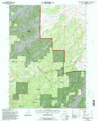
Saddleback Mtn, Wyoming, USGS topographic map dated 1992.
Includes geographic coordinates (latitude and longitude). This topographic map is suitable for hiking, camping, and exploring, or framing it as a wall map.
Printed on-demand using high resolution imagery, on heavy weight and acid free paper, or alternatively on a variety of synthetic materials.
Topos available on paper, Waterproof, Poly, or Tyvek. Usually shipping rolled, unless combined with other folded maps in one order.
- Product Number: USGS-5615396
- Free digital map download (high-resolution, GeoPDF): Saddleback Mtn, Wyoming (file size: 19 MB)
- Map Size: please refer to the dimensions of the GeoPDF map above
- Weight (paper map): ca. 55 grams
- Map Type: POD USGS Topographic Map
- Map Series: HTMC
- Map Verison: Historical
- Cell ID: 39150
- Scan ID: 341201
- Imprint Year: 1996
- Woodland Tint: Yes
- Aerial Photo Year: 1990
- Field Check Year: 1992
- Datum: NAD27
- Map Projection: Transverse Mercator
- Map published by United States Geological Survey
- Map published by United States Forest Service
- Map Language: English
- Scanner Resolution: 600 dpi
- Map Cell Name: Saddleback Mountain
- Grid size: 7.5 X 7.5 Minute
- Date on map: 1992
- Map Scale: 1:24000
- Geographical region: Wyoming, United States
Neighboring Maps:
All neighboring USGS topo maps are available for sale online at a variety of scales.
Spatial coverage:
Topo map Saddleback Mtn, Wyoming, covers the geographical area associated the following places:
- Bunchem Creek - West Fork Pass - Baldy Peak - Cummings Creek - Jenkins Pass - Slick Rock - Deere Creek - Dunn Reservoir Number 1 - South Park Creek - Dunn Number 1 Dam - Little Bear Canyon - Little Horse Creek - Morrison Park - Little Bear Creek - Baldy Ridge - Spring Creek - Curtis Gulch Campground - North Sawtooth Mountain - McDonald Cabin - Horse Creek - Willox Park - Saddleback Mountain - Burnt Mountain - French Joe Creek - South Sawtooth Mountain - Middle Sawtooth Mountain - Cummings Park - Deer Canyon
- Map Area ID: AREA42.542.375-105.625-105.5
- Northwest corner Lat/Long code: USGSNW42.5-105.625
- Northeast corner Lat/Long code: USGSNE42.5-105.5
- Southwest corner Lat/Long code: USGSSW42.375-105.625
- Southeast corner Lat/Long code: USGSSE42.375-105.5
- Northern map edge Latitude: 42.5
- Southern map edge Latitude: 42.375
- Western map edge Longitude: -105.625
- Eastern map edge Longitude: -105.5


