
~ Round Top Lake WY topo map, 1:24000 scale, 7.5 X 7.5 Minute, Historical, 1961, updated 1963
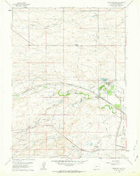
Round Top Lake, Wyoming, USGS topographic map dated 1961.
Includes geographic coordinates (latitude and longitude). This topographic map is suitable for hiking, camping, and exploring, or framing it as a wall map.
Printed on-demand using high resolution imagery, on heavy weight and acid free paper, or alternatively on a variety of synthetic materials.
Topos available on paper, Waterproof, Poly, or Tyvek. Usually shipping rolled, unless combined with other folded maps in one order.
- Product Number: USGS-5615340
- Free digital map download (high-resolution, GeoPDF): Round Top Lake, Wyoming (file size: 10 MB)
- Map Size: please refer to the dimensions of the GeoPDF map above
- Weight (paper map): ca. 55 grams
- Map Type: POD USGS Topographic Map
- Map Series: HTMC
- Map Verison: Historical
- Cell ID: 38768
- Scan ID: 341176
- Imprint Year: 1963
- Woodland Tint: Yes
- Aerial Photo Year: 1960
- Field Check Year: 1961
- Survey Year: 1948
- Datum: NAD27
- Map Projection: Polyconic
- Map published by United States Geological Survey
- Map Language: English
- Scanner Resolution: 600 dpi
- Map Cell Name: Round Top Lake
- Grid size: 7.5 X 7.5 Minute
- Date on map: 1961
- Map Scale: 1:24000
- Geographical region: Wyoming, United States
Neighboring Maps:
All neighboring USGS topo maps are available for sale online at a variety of scales.
Spatial coverage:
Topo map Round Top Lake, Wyoming, covers the geographical area associated the following places:
- Bell Number 14 Well - Bell Number 16 Well - Eddy Well - Fred Hersig Reservoir - Meadowlark Ranch - Koppes Number 2 Well - Bailey Number 5 Well - Carpenter Mill Camp - Shellback - King Number 4 Well - Round Top Lake - Koppes Number 1 Well - Happy Jack Number 3 Well - Bailey Number 1 Well - John W Griffen Dam - Holman Well - King Reservoir - Bell Number 17 Well - Bell Number 5 Well - Bell Number 6 Well - Bell Number 11 Well - Happy Jack Number 1 Well - Bell Number 24 Well - Elkar Number 1 Well - Bell Number 15 Well - Spring Creek - KKTU-TV (Cheyenne) - Round Top - John W Griffen Reservoir - Bell Number 10 Well - Fred Hersig Dam - Experiment Station Dam - High Plains Grasslands Research Station - Wyoming Angus Ranch - Bell Number 8 Well - King Number 2 Well - Bell Number 25 Well - Koppes Number 3 Well - Bell Number 12 Well - Elkar Number 3 Well - Corriedale Ranch - Equalizing Reservoir - Bell Ranch - Koppes Number 4 Well - Happy Jack Number 2 Well - Shell Back Ranch
- Map Area ID: AREA41.2541.125-105-104.875
- Northwest corner Lat/Long code: USGSNW41.25-105
- Northeast corner Lat/Long code: USGSNE41.25-104.875
- Southwest corner Lat/Long code: USGSSW41.125-105
- Southeast corner Lat/Long code: USGSSE41.125-104.875
- Northern map edge Latitude: 41.25
- Southern map edge Latitude: 41.125
- Western map edge Longitude: -105
- Eastern map edge Longitude: -104.875


