
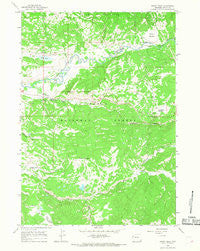
~ Rosies Ridge WY topo map, 1:24000 scale, 7.5 X 7.5 Minute, Historical, 1965, updated 1968
Rosies Ridge, Wyoming, USGS topographic map dated 1965.
Includes geographic coordinates (latitude and longitude). This topographic map is suitable for hiking, camping, and exploring, or framing it as a wall map.
Printed on-demand using high resolution imagery, on heavy weight and acid free paper, or alternatively on a variety of synthetic materials.
Topos available on paper, Waterproof, Poly, or Tyvek. Usually shipping rolled, unless combined with other folded maps in one order.
- Product Number: USGS-5615314
- Free digital map download (high-resolution, GeoPDF): Rosies Ridge, Wyoming (file size: 11 MB)
- Map Size: please refer to the dimensions of the GeoPDF map above
- Weight (paper map): ca. 55 grams
- Map Type: POD USGS Topographic Map
- Map Series: HTMC
- Map Verison: Historical
- Cell ID: 38646
- Scan ID: 341162
- Imprint Year: 1968
- Woodland Tint: Yes
- Aerial Photo Year: 1964
- Field Check Year: 1965
- Datum: NAD27
- Map Projection: Polyconic
- Map published by United States Geological Survey
- Map Language: English
- Scanner Resolution: 600 dpi
- Map Cell Name: Rosies Ridge
- Grid size: 7.5 X 7.5 Minute
- Date on map: 1965
- Map Scale: 1:24000
- Geographical region: Wyoming, United States
Neighboring Maps:
All neighboring USGS topo maps are available for sale online at a variety of scales.
Spatial coverage:
Topo map Rosies Ridge, Wyoming, covers the geographical area associated the following places:
- Blackrock Ranger District Office - Box Creek - Preacher Park - Boy Creek Trailhead - Lily Lake - Skull Creek Meadows - South Fork Spread Creek - Rosies Ridge - Hatchet Campground - Turpin Meadow Lodge - Tracy Lake - Blackrock Ranger Station - Baldy Mountain - Turpin Meadow Trailhead - Sagebrush Flat - Tracy Lake Dam - Flagstaff Creek - Turpin Meadow - Tracy Lake - Marys Lake - Burro Hill - Clear Creek Trail - Fourmile Meadow Picnic Area - Blackrock Creek - Turpin Meadow Campground - Fourmile Meadow - Bridger - Teton National Forest Blackrock - Buffalo Ranger District Fire Engine Crew - North Fork Spread Creek
- Map Area ID: AREA43.87543.75-110.375-110.25
- Northwest corner Lat/Long code: USGSNW43.875-110.375
- Northeast corner Lat/Long code: USGSNE43.875-110.25
- Southwest corner Lat/Long code: USGSSW43.75-110.375
- Southeast corner Lat/Long code: USGSSE43.75-110.25
- Northern map edge Latitude: 43.875
- Southern map edge Latitude: 43.75
- Western map edge Longitude: -110.375
- Eastern map edge Longitude: -110.25


