
~ Red Canyon Creek WY topo map, 1:24000 scale, 7.5 X 7.5 Minute, Historical, 1984, updated 1984
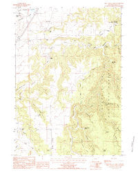
Red Canyon Creek, Wyoming, USGS topographic map dated 1984.
Includes geographic coordinates (latitude and longitude). This topographic map is suitable for hiking, camping, and exploring, or framing it as a wall map.
Printed on-demand using high resolution imagery, on heavy weight and acid free paper, or alternatively on a variety of synthetic materials.
Topos available on paper, Waterproof, Poly, or Tyvek. Usually shipping rolled, unless combined with other folded maps in one order.
- Product Number: USGS-5615044
- Free digital map download (high-resolution, GeoPDF): Red Canyon Creek, Wyoming (file size: 12 MB)
- Map Size: please refer to the dimensions of the GeoPDF map above
- Weight (paper map): ca. 55 grams
- Map Type: POD USGS Topographic Map
- Map Series: HTMC
- Map Verison: Historical
- Cell ID: 37305
- Scan ID: 341030
- Imprint Year: 1984
- Woodland Tint: Yes
- Aerial Photo Year: 1980
- Edit Year: 1984
- Field Check Year: 1981
- Datum: NAD27
- Map Projection: Transverse Mercator
- Provisional map: Yes
- Map published by United States Geological Survey
- Map Language: English
- Scanner Resolution: 600 dpi
- Map Cell Name: Red Canyon Creek
- Grid size: 7.5 X 7.5 Minute
- Date on map: 1984
- Map Scale: 1:24000
- Geographical region: Wyoming, United States
Neighboring Maps:
All neighboring USGS topo maps are available for sale online at a variety of scales.
Spatial coverage:
Topo map Red Canyon Creek, Wyoming, covers the geographical area associated the following places:
- Bush Ranch - Surprise Gulch Spring - Cranberry Springs Gulch - Poison Creek - Hegge Ranch - Surprise Gulch - Idol Gulch - Rocky Ford Reservoir - Lincoln Ranch - Miller Ranch - Hamilton Spring - Deer Corral Spring - Black Haw Gulch - Seely Ranch - Grand Canyon - Thompson Gulch - Cranberry Spring - Corral Creek - Cold Springs Creek - Jones Ranch - Buck Hollow - Riflepit Divide - Bear Creek Mountains Mine - Spring Draw - Jones, Bury, and Murdock Property Number One Mine - Rocky Ford Dam - Manhattan Gulch - Red Canyon Creek - Koksh Ranch - Rocky Ford Creek - Quail Spring - Thompson Ranch - Knapp Spring - Green Mountain Draw - Inum Group Mine - Williams Divide
- Map Area ID: AREA44.544.375-104.25-104.125
- Northwest corner Lat/Long code: USGSNW44.5-104.25
- Northeast corner Lat/Long code: USGSNE44.5-104.125
- Southwest corner Lat/Long code: USGSSW44.375-104.25
- Southeast corner Lat/Long code: USGSSE44.375-104.125
- Northern map edge Latitude: 44.5
- Southern map edge Latitude: 44.375
- Western map edge Longitude: -104.25
- Eastern map edge Longitude: -104.125


