
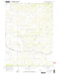
~ Raspberry Ridge WY topo map, 1:24000 scale, 7.5 X 7.5 Minute, Historical, 1967, updated 1971
Raspberry Ridge, Wyoming, USGS topographic map dated 1967.
Includes geographic coordinates (latitude and longitude). This topographic map is suitable for hiking, camping, and exploring, or framing it as a wall map.
Printed on-demand using high resolution imagery, on heavy weight and acid free paper, or alternatively on a variety of synthetic materials.
Topos available on paper, Waterproof, Poly, or Tyvek. Usually shipping rolled, unless combined with other folded maps in one order.
- Product Number: USGS-5614988
- Free digital map download (high-resolution, GeoPDF): Raspberry Ridge, Wyoming (file size: 9 MB)
- Map Size: please refer to the dimensions of the GeoPDF map above
- Weight (paper map): ca. 55 grams
- Map Type: POD USGS Topographic Map
- Map Series: HTMC
- Map Verison: Historical
- Cell ID: 37082
- Scan ID: 340998
- Imprint Year: 1971
- Woodland Tint: Yes
- Visual Version Number: 1
- Aerial Photo Year: 1966
- Field Check Year: 1967
- Datum: NAD27
- Map Projection: Polyconic
- Map published by United States Geological Survey
- Map Language: English
- Scanner Resolution: 600 dpi
- Map Cell Name: Raspberry Ridge
- Grid size: 7.5 X 7.5 Minute
- Date on map: 1967
- Map Scale: 1:24000
- Geographical region: Wyoming, United States
Neighboring Maps:
All neighboring USGS topo maps are available for sale online at a variety of scales.
Spatial coverage:
Topo map Raspberry Ridge, Wyoming, covers the geographical area associated the following places:
- Blackrock Ranger District - Sled Runner Creek - Slide Creek - Stub Creek - Bondurant Post Office - North Fork Fisherman Creek - Fortress Hill - Mill Creek - Fisherman Pit Mine - Fisherman Creek - South Fork Fisherman Creek - Fisherman Creek - Jenny Creek - Sour Moose Creek - Dry Island - Muddy Creek - Raspberry Ridge - Robinson Butte - Riling Draw - Elbow Draw - Jack Creek Basin - Sandrock Creek
- Map Area ID: AREA43.2543.125-110.375-110.25
- Northwest corner Lat/Long code: USGSNW43.25-110.375
- Northeast corner Lat/Long code: USGSNE43.25-110.25
- Southwest corner Lat/Long code: USGSSW43.125-110.375
- Southeast corner Lat/Long code: USGSSE43.125-110.25
- Northern map edge Latitude: 43.25
- Southern map edge Latitude: 43.125
- Western map edge Longitude: -110.375
- Eastern map edge Longitude: -110.25


