
~ Ramshorn Peak WY topo map, 1:24000 scale, 7.5 X 7.5 Minute, Historical, 1956, updated 1995
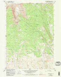
Ramshorn Peak, Wyoming, USGS topographic map dated 1956.
Includes geographic coordinates (latitude and longitude). This topographic map is suitable for hiking, camping, and exploring, or framing it as a wall map.
Printed on-demand using high resolution imagery, on heavy weight and acid free paper, or alternatively on a variety of synthetic materials.
Topos available on paper, Waterproof, Poly, or Tyvek. Usually shipping rolled, unless combined with other folded maps in one order.
- Product Number: USGS-5614972
- Free digital map download (high-resolution, GeoPDF): Ramshorn Peak, Wyoming (file size: 13 MB)
- Map Size: please refer to the dimensions of the GeoPDF map above
- Weight (paper map): ca. 55 grams
- Map Type: POD USGS Topographic Map
- Map Series: HTMC
- Map Verison: Historical
- Cell ID: 36995
- Scan ID: 340991
- Imprint Year: 1995
- Woodland Tint: Yes
- Photo Inspection Year: 1977
- Aerial Photo Year: 1953
- Field Check Year: 1956
- Datum: NAD27
- Map Projection: Transverse Mercator
- Map published by United States Geological Survey
- Map Language: English
- Scanner Resolution: 600 dpi
- Map Cell Name: Ramshorn Peak
- Grid size: 7.5 X 7.5 Minute
- Date on map: 1956
- Map Scale: 1:24000
- Geographical region: Wyoming, United States
Neighboring Maps:
All neighboring USGS topo maps are available for sale online at a variety of scales.
Spatial coverage:
Topo map Ramshorn Peak, Wyoming, covers the geographical area associated the following places:
- Amoretti Park - Ramshorn Peak - Ramshorn Trail - Parque Creek Trail - Burroughs Creek Trail - Ramshorn Basin - White Pass - E A Mountain - Houg Ranch - Burroughs Creek - Deacon Meadows - Adams Ranch - Virgin Lake - Parque Creek - T Cross Ranch - Brent Creek - Rainbow Lake - Fisher Tie Camp - Deacon Flat - Burnt Timber Lake - Battrum Mountain - Ramshorn Lakes - Horse Creek Ranger Station - Carson Lake - Utzinger Ranch
- Map Area ID: AREA43.7543.625-109.75-109.625
- Northwest corner Lat/Long code: USGSNW43.75-109.75
- Northeast corner Lat/Long code: USGSNE43.75-109.625
- Southwest corner Lat/Long code: USGSSW43.625-109.75
- Southeast corner Lat/Long code: USGSSE43.625-109.625
- Northern map edge Latitude: 43.75
- Southern map edge Latitude: 43.625
- Western map edge Longitude: -109.75
- Eastern map edge Longitude: -109.625


