
~ Poison Basin WY topo map, 1:24000 scale, 7.5 X 7.5 Minute, Historical, 1970, updated 1973
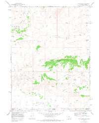
Poison Basin, Wyoming, USGS topographic map dated 1970.
Includes geographic coordinates (latitude and longitude). This topographic map is suitable for hiking, camping, and exploring, or framing it as a wall map.
Printed on-demand using high resolution imagery, on heavy weight and acid free paper, or alternatively on a variety of synthetic materials.
Topos available on paper, Waterproof, Poly, or Tyvek. Usually shipping rolled, unless combined with other folded maps in one order.
- Product Number: USGS-5614820
- Free digital map download (high-resolution, GeoPDF): Poison Basin, Wyoming (file size: 6 MB)
- Map Size: please refer to the dimensions of the GeoPDF map above
- Weight (paper map): ca. 55 grams
- Map Type: POD USGS Topographic Map
- Map Series: HTMC
- Map Verison: Historical
- Cell ID: 35822
- Scan ID: 654092
- Imprint Year: 1973
- Woodland Tint: Yes
- Visual Version Number: 1
- Aerial Photo Year: 1968
- Field Check Year: 1970
- Datum: NAD27
- Map Projection: Polyconic
- Map published by United States Geological Survey
- Map Language: English
- Scanner Resolution: 508 dpi
- Map Cell Name: Poison Basin
- Grid size: 7.5 X 7.5 Minute
- Date on map: 1970
- Map Scale: 1:24000
- Geographical region: Wyoming, United States
Neighboring Maps:
All neighboring USGS topo maps are available for sale online at a variety of scales.
Spatial coverage:
Topo map Poison Basin, Wyoming, covers the geographical area associated the following places:
- Gamblers Reservoir - Woodbury Ditch - Heeley Ditch - Matt Three Mine - Jack Rabbit One-ten Mines - Poison Buttes - Dead Tree Reservoir - Teton Three Mine - Middle Prong Red Creek - Alpha Claim Group Mine - Long Walk Reservoir - Main Fork Trail - Paintbrush Reservoir - Cedar Hills One-twelve Mines - North Prong Red Creek - Darr Ditch - Poison Basin - Red Creek - Heeley Ditch - Darr Ditch - Sand Creek - Teton One Mine - Gibson Blair Ditch - Red Creek Rim - Strom Reservoir - Home Ditch - Red Creek Reservoir - Titan Mine - Poison Draw - Spragg Reservoir - Murphy Mine - River Bottom Reservoir - Woodbury Ditch - Flat Draw Reservoir - Lucky Strike Claims - Adobe Reservoir
- Map Area ID: AREA41.12541-107.875-107.75
- Northwest corner Lat/Long code: USGSNW41.125-107.875
- Northeast corner Lat/Long code: USGSNE41.125-107.75
- Southwest corner Lat/Long code: USGSSW41-107.875
- Southeast corner Lat/Long code: USGSSE41-107.75
- Northern map edge Latitude: 41.125
- Southern map edge Latitude: 41
- Western map edge Longitude: -107.875
- Eastern map edge Longitude: -107.75


