
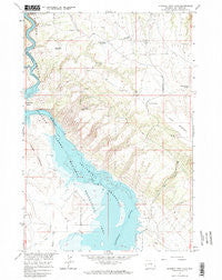
~ Natural Trap Cave WY topo map, 1:24000 scale, 7.5 X 7.5 Minute, Historical, 1964, updated 1968
Natural Trap Cave, Wyoming, USGS topographic map dated 1964.
Includes geographic coordinates (latitude and longitude). This topographic map is suitable for hiking, camping, and exploring, or framing it as a wall map.
Printed on-demand using high resolution imagery, on heavy weight and acid free paper, or alternatively on a variety of synthetic materials.
Topos available on paper, Waterproof, Poly, or Tyvek. Usually shipping rolled, unless combined with other folded maps in one order.
- Product Number: USGS-5614228
- Free digital map download (high-resolution, GeoPDF): Natural Trap Cave, Wyoming (file size: 13 MB)
- Map Size: please refer to the dimensions of the GeoPDF map above
- Weight (paper map): ca. 55 grams
- Map Type: POD USGS Topographic Map
- Map Series: HTMC
- Map Verison: Historical
- Cell ID: 31403
- Scan ID: 340640
- Imprint Year: 1968
- Woodland Tint: Yes
- Aerial Photo Year: 1963
- Field Check Year: 1964
- Datum: NAD27
- Map Projection: Polyconic
- Map published by United States Geological Survey
- Map Language: English
- Scanner Resolution: 600 dpi
- Map Cell Name: Natural Trap Cave
- Grid size: 7.5 X 7.5 Minute
- Date on map: 1964
- Map Scale: 1:24000
- Geographical region: Wyoming, United States
Neighboring Maps:
All neighboring USGS topo maps are available for sale online at a variety of scales.
Spatial coverage:
Topo map Natural Trap Cave, Wyoming, covers the geographical area associated the following places:
- Cedar Buttes Reservoir - Avery Claims Mine - Whitehead Claims Mine - Little Spring - School Section Spring - Cave Group Mine - Horseshoe Group Mine - Tri-pacer Number Four Mine - Pass Reservoir - High Noon Claims Mine - John Blue Canyon - Horseshoe Claim Number Nine Mine - Smith-Powleson Claim Mine - Dirty Beast Mine - Titan Mine - Fuesner and Sons Mine - Saunders Mine - Midnight Mine - Georges Spring - Big Fork Canal - Modern Mines Mine - Lisbon Mines - Little Mountain Mine - Glory Hole - Super Cub Mine - Lone Hill Reservoir - Midnight Mine - Midnight Mine - Little Mountain - The Narrows River - Mike 1-10 Mine - Tri Pacer Number Five Mine - Mickey 2-10 Mine - John Claim Mine - Tri Pacer Number Four Mine - High Noon Mine - Iona - Kane Cemetery - Western Bighorn Group Mine - Little Mountain Mine - Mike Number Ten Mine - Horseshoe Claims Number Ten Mine
- Map Area ID: AREA4544.875-108.25-108.125
- Northwest corner Lat/Long code: USGSNW45-108.25
- Northeast corner Lat/Long code: USGSNE45-108.125
- Southwest corner Lat/Long code: USGSSW44.875-108.25
- Southeast corner Lat/Long code: USGSSE44.875-108.125
- Northern map edge Latitude: 45
- Southern map edge Latitude: 44.875
- Western map edge Longitude: -108.25
- Eastern map edge Longitude: -108.125


