
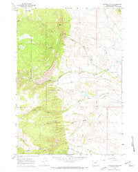
~ Klondike Ranch WY topo map, 1:24000 scale, 7.5 X 7.5 Minute, Historical, 1967, updated 1972
Klondike Ranch, Wyoming, USGS topographic map dated 1967.
Includes geographic coordinates (latitude and longitude). This topographic map is suitable for hiking, camping, and exploring, or framing it as a wall map.
Printed on-demand using high resolution imagery, on heavy weight and acid free paper, or alternatively on a variety of synthetic materials.
Topos available on paper, Waterproof, Poly, or Tyvek. Usually shipping rolled, unless combined with other folded maps in one order.
- Product Number: USGS-5613130
- Free digital map download (high-resolution, GeoPDF): Klondike Ranch, Wyoming (file size: 11 MB)
- Map Size: please refer to the dimensions of the GeoPDF map above
- Weight (paper map): ca. 55 grams
- Map Type: POD USGS Topographic Map
- Map Series: HTMC
- Map Verison: Historical
- Cell ID: 70582
- Scan ID: 340102
- Imprint Year: 1972
- Woodland Tint: Yes
- Aerial Photo Year: 1966
- Field Check Year: 1967
- Datum: NAD27
- Map Projection: Polyconic
- Map published by United States Geological Survey
- Map Language: English
- Scanner Resolution: 600 dpi
- Map Cell Name: Klondike Ranch
- Grid size: 7.5 X 7.5 Minute
- Date on map: 1967
- Map Scale: 1:24000
- Geographical region: Wyoming, United States
Neighboring Maps:
All neighboring USGS topo maps are available for sale online at a variety of scales.
Spatial coverage:
Topo map Klondike Ranch, Wyoming, covers the geographical area associated the following places:
- Little North Fork Crazy Woman Creek - Blue Gap Ditch Number 19 - Gossett Creek - Louise Creek - Muddy Guard Reservoir Number 1 - Roe Brothers Group Mine - Muffie Reservoir - Spring Draw - Thompson and Mathews Ditch Number 35 - Crazy Woman Mountain - Patch Dam - Muddy Creek Mine - Elgin Creek - Muffie Dam - Muddy Guard Reservoir Number 2 - Tass Reservoir - Sisters Hill - Dry Muddy Canyon - Patch Reservoir - Muddy Guard Reservoir Number 1 Dam - Klondike Ranch - Sisters Hill Mine - Tass Dam - Webber Creek - Elgin Park - Louise Creek - Rice Ditch Number 1 - Red Bank Ditch Number 2 - Muddy Guard Reservoir Number 2 Dam - Webber Creek - Gossett Canyon - Big Horn Mountains Number One Mine - Cook Ditch Number 9
- Map Area ID: AREA44.2544.125-106.875-106.75
- Northwest corner Lat/Long code: USGSNW44.25-106.875
- Northeast corner Lat/Long code: USGSNE44.25-106.75
- Southwest corner Lat/Long code: USGSSW44.125-106.875
- Southeast corner Lat/Long code: USGSSE44.125-106.75
- Northern map edge Latitude: 44.25
- Southern map edge Latitude: 44.125
- Western map edge Longitude: -106.875
- Eastern map edge Longitude: -106.75


