
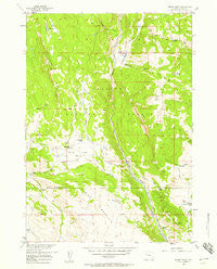
~ Indian Point WY topo map, 1:24000 scale, 7.5 X 7.5 Minute, Historical, 1956, updated 1958
Indian Point, Wyoming, USGS topographic map dated 1956.
Includes geographic coordinates (latitude and longitude). This topographic map is suitable for hiking, camping, and exploring, or framing it as a wall map.
Printed on-demand using high resolution imagery, on heavy weight and acid free paper, or alternatively on a variety of synthetic materials.
Topos available on paper, Waterproof, Poly, or Tyvek. Usually shipping rolled, unless combined with other folded maps in one order.
- Product Number: USGS-5612840
- Free digital map download (high-resolution, GeoPDF): Indian Point, Wyoming (file size: 12 MB)
- Map Size: please refer to the dimensions of the GeoPDF map above
- Weight (paper map): ca. 55 grams
- Map Type: POD USGS Topographic Map
- Map Series: HTMC
- Map Verison: Historical
- Cell ID: 21860
- Scan ID: 339957
- Imprint Year: 1958
- Woodland Tint: Yes
- Aerial Photo Year: 1953
- Field Check Year: 1956
- Datum: NAD27
- Map Projection: Polyconic
- Map published by United States Geological Survey
- Map Language: English
- Scanner Resolution: 600 dpi
- Map Cell Name: Indian Point
- Grid size: 7.5 X 7.5 Minute
- Date on map: 1956
- Map Scale: 1:24000
- Geographical region: Wyoming, United States
Neighboring Maps:
All neighboring USGS topo maps are available for sale online at a variety of scales.
Spatial coverage:
Topo map Indian Point, Wyoming, covers the geographical area associated the following places:
- Charlie Creek - Bartrand Spring - Indian Point Trail - Bain Cabin - Beck Cow Camp - East Fork Elk Winter Pasture Headquarters - Green Lake - Telephone Draw - Indian Ridge - High Acres Ranch - Mud Lake - Rocking Chair Cow Camp - Hough Meadow - Eastman Place (historical) - Indian Point - Bear Pass - Hough Cabin - Simmerson Place - Windy Gap - Cartridge Creek - Black Mountain - Livingston Cabin - Bog Lakes - Spring Mountain Cow Camp - Bear Creek Canyon - Boundary Trail - Horse Creek Basin - Bull Elk Pass - Spring Mountain - Elkhorn Ridge
- Map Area ID: AREA43.7543.625-109.625-109.5
- Northwest corner Lat/Long code: USGSNW43.75-109.625
- Northeast corner Lat/Long code: USGSNE43.75-109.5
- Southwest corner Lat/Long code: USGSSW43.625-109.625
- Southeast corner Lat/Long code: USGSSE43.625-109.5
- Northern map edge Latitude: 43.75
- Southern map edge Latitude: 43.625
- Western map edge Longitude: -109.625
- Eastern map edge Longitude: -109.5


