
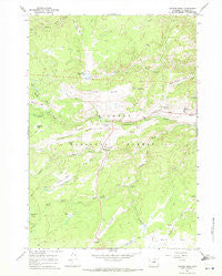
~ Hunter Mesa WY topo map, 1:24000 scale, 7.5 X 7.5 Minute, Historical, 1967, updated 1971
Hunter Mesa, Wyoming, USGS topographic map dated 1967.
Includes geographic coordinates (latitude and longitude). This topographic map is suitable for hiking, camping, and exploring, or framing it as a wall map.
Printed on-demand using high resolution imagery, on heavy weight and acid free paper, or alternatively on a variety of synthetic materials.
Topos available on paper, Waterproof, Poly, or Tyvek. Usually shipping rolled, unless combined with other folded maps in one order.
- Product Number: USGS-5612754
- Free digital map download (high-resolution, GeoPDF): Hunter Mesa, Wyoming (file size: 11 MB)
- Map Size: please refer to the dimensions of the GeoPDF map above
- Weight (paper map): ca. 55 grams
- Map Type: POD USGS Topographic Map
- Map Series: HTMC
- Map Verison: Historical
- Cell ID: 21503
- Scan ID: 339915
- Imprint Year: 1971
- Woodland Tint: Yes
- Aerial Photo Year: 1966
- Field Check Year: 1967
- Datum: NAD27
- Map Projection: Polyconic
- Map published by United States Geological Survey
- Map Language: English
- Scanner Resolution: 600 dpi
- Map Cell Name: Hunter Mesa
- Grid size: 7.5 X 7.5 Minute
- Date on map: 1967
- Map Scale: 1:24000
- Geographical region: Wyoming, United States
Neighboring Maps:
All neighboring USGS topo maps are available for sale online at a variety of scales.
Spatial coverage:
Topo map Hunter Mesa, Wyoming, covers the geographical area associated the following places:
- East Hunter Mesa Spring - Hettinger Picnic Area - Hunter Creek - Mosier Springs - South Fork Campground - Little Sourdough Creek - Paradise Ranch - Oliver Creek - Hospital Hill Springs - Sourdough Creek - Rabbit Creek - Middle Fork Campground - Circle Park Campground - Cross H Cow Camp - South Clear Creek - Hunter Ranger Station - Middle Clear Creek - Webber Park - Lucasta Camp - Sourdough Campground - Lynx Park - Seven Brothers Creek - French Creek Cow Camp - The Pines - County Youth Camp - Foot Creek - Hunter Corral - Duck Creek - Fox Cabin Spring - Hondo Creek - North Clear Creek - Cow Camp Spring - Schoolhouse Park - Circle Park Creek - Tie Hack Campground - Cull Watt Park - Circle Park - Buffalo Park - Hunter Mesa - North Fork Picnic Area
- Map Area ID: AREA44.37544.25-107-106.875
- Northwest corner Lat/Long code: USGSNW44.375-107
- Northeast corner Lat/Long code: USGSNE44.375-106.875
- Southwest corner Lat/Long code: USGSSW44.25-107
- Southeast corner Lat/Long code: USGSSE44.25-106.875
- Northern map edge Latitude: 44.375
- Southern map edge Latitude: 44.25
- Western map edge Longitude: -107
- Eastern map edge Longitude: -106.875


